HOME

 SGWD HENRHYD (HENRHYD WATERFALL), COELBREN, POWYS.

BRECON BEACONS NATIONAL PARK

"The highest waterfall in south Wales"


HOW TO GET THERE  -  FAMOUS VISITORS  -  BATMAN  -  LINKS  -  THE WALK

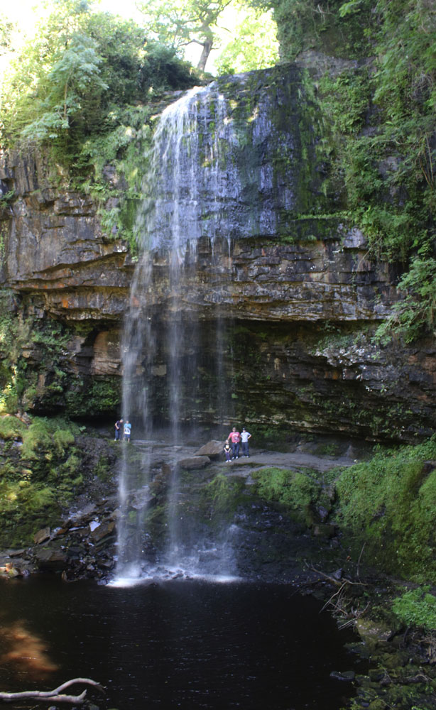
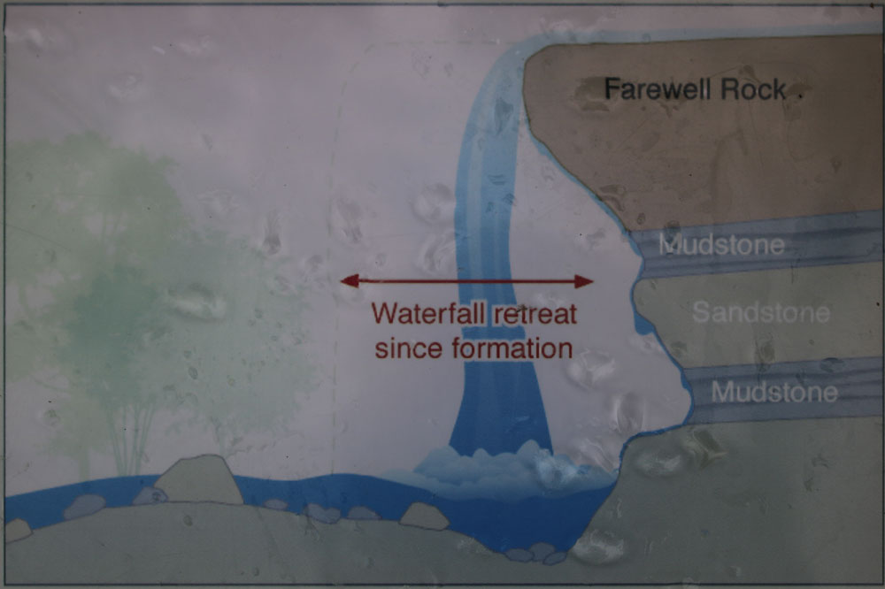
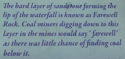
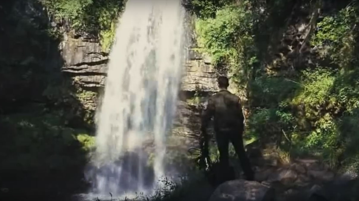
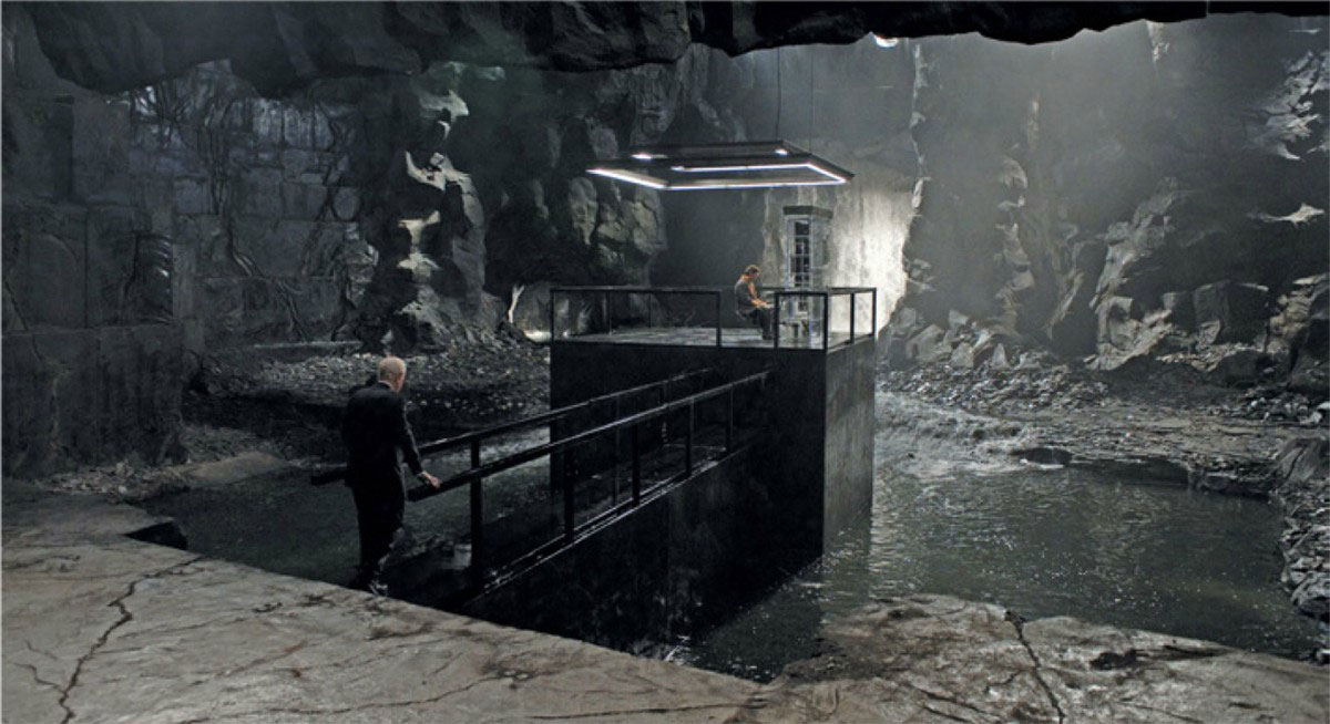
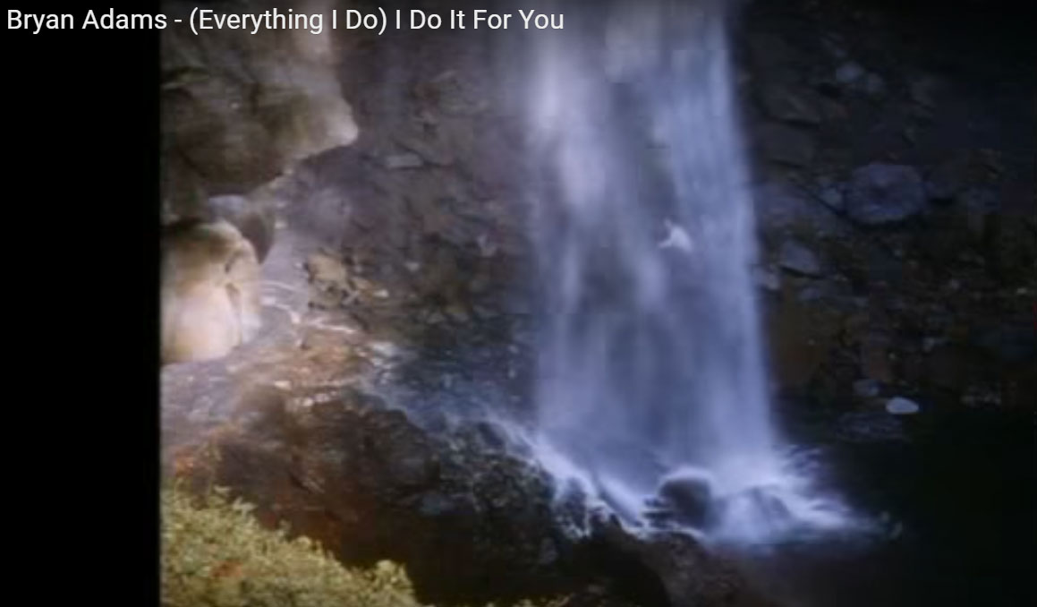
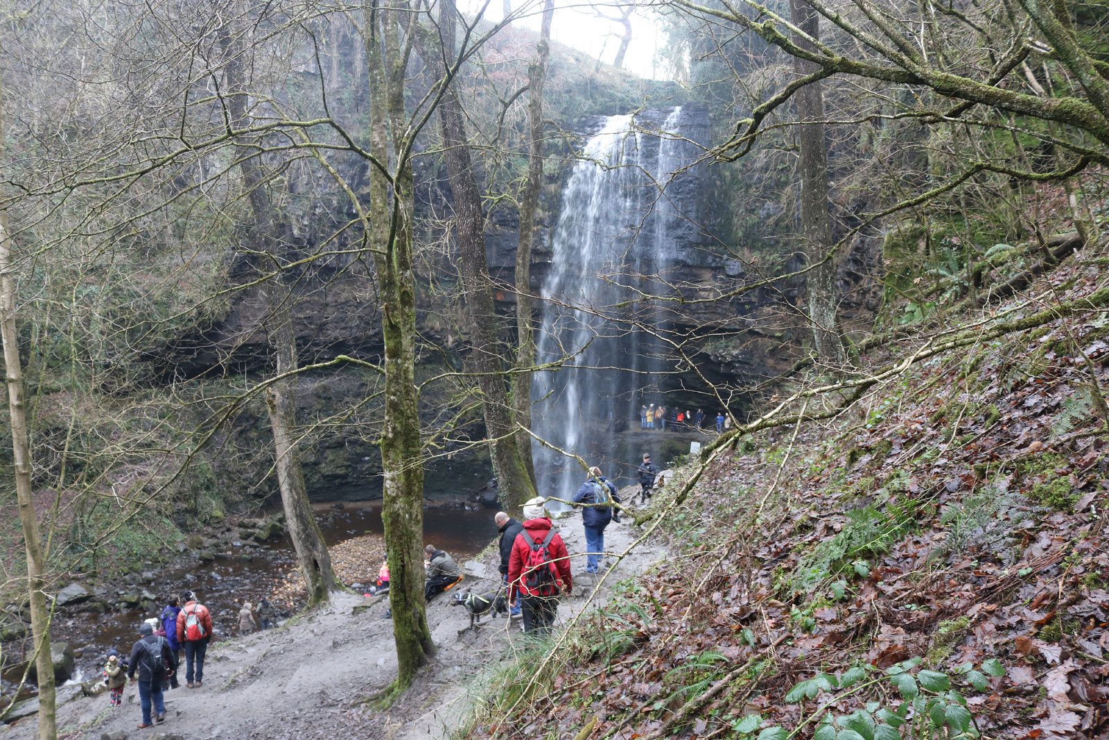
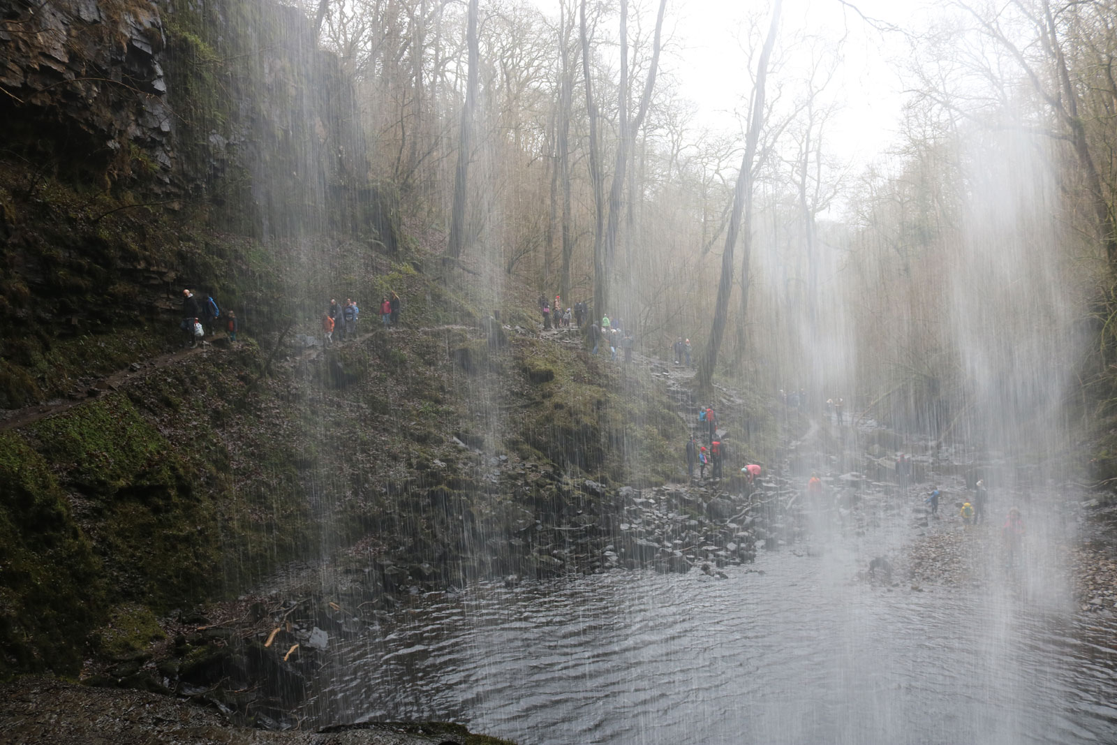
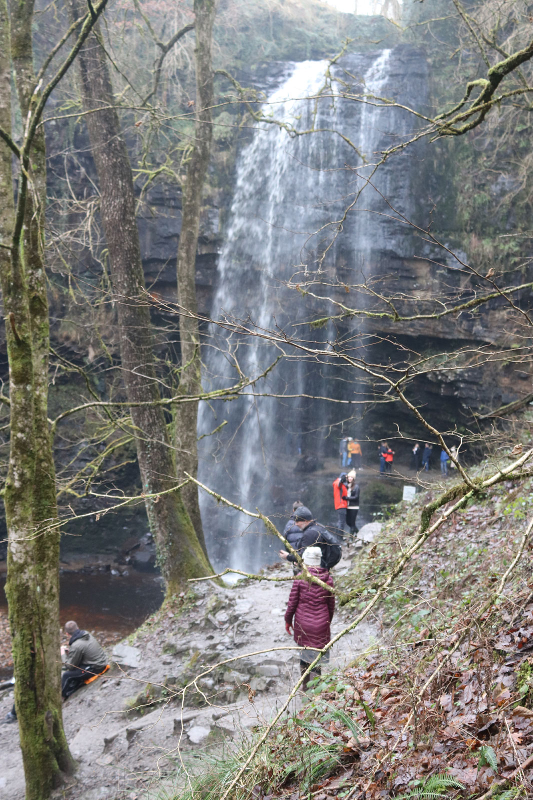
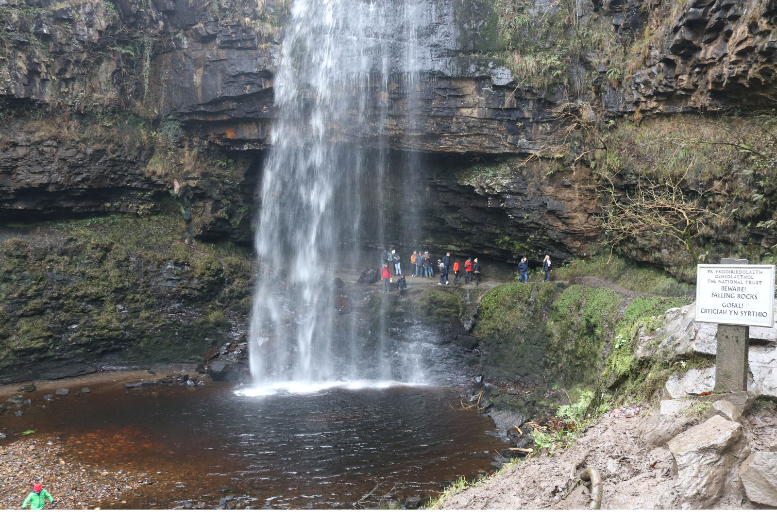
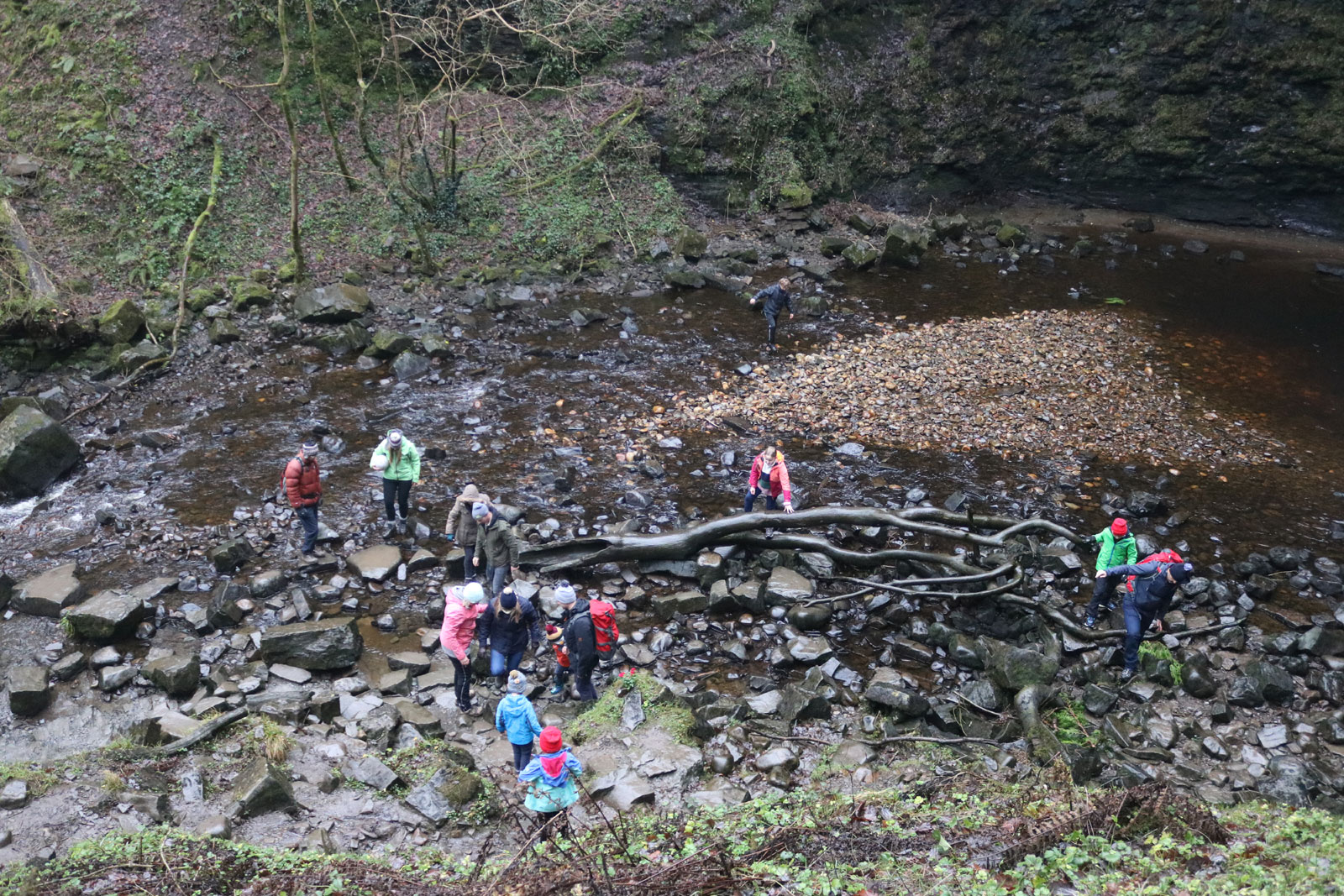
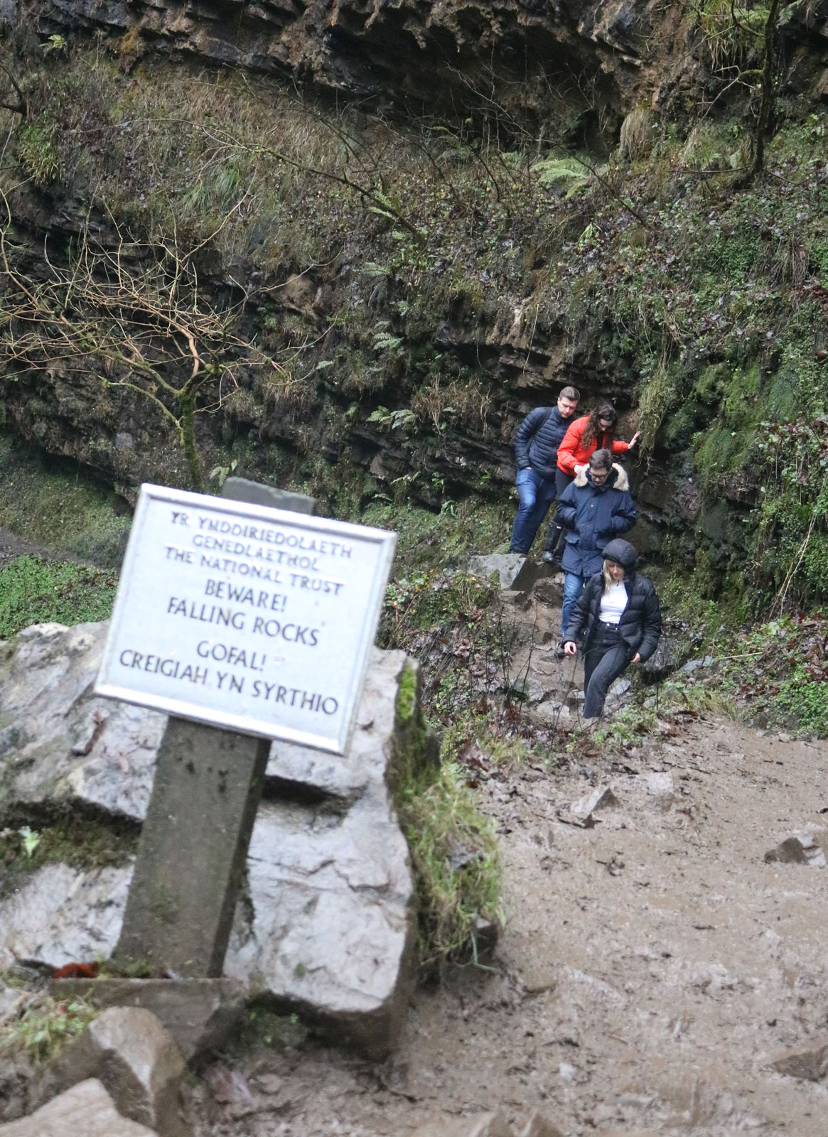
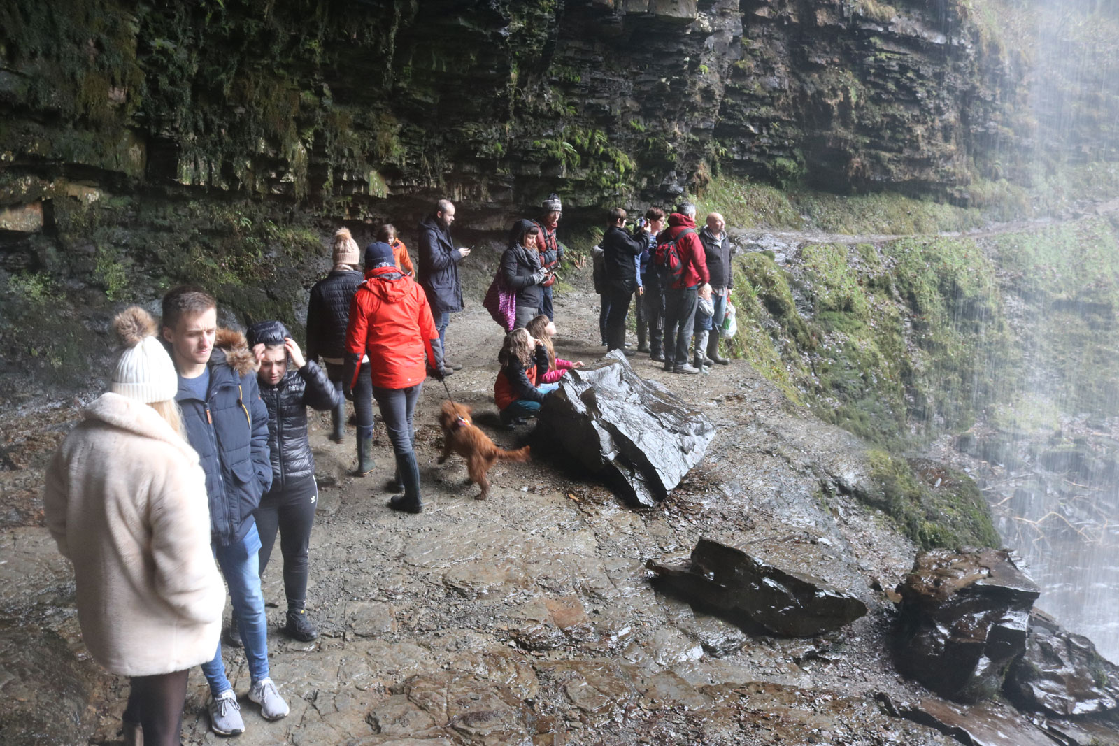
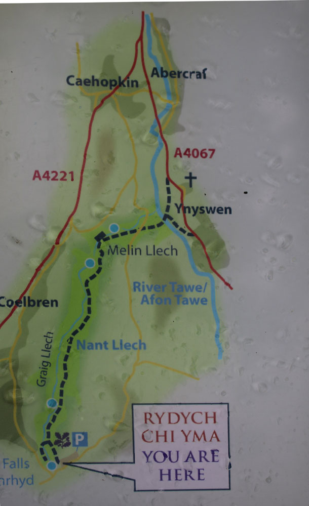
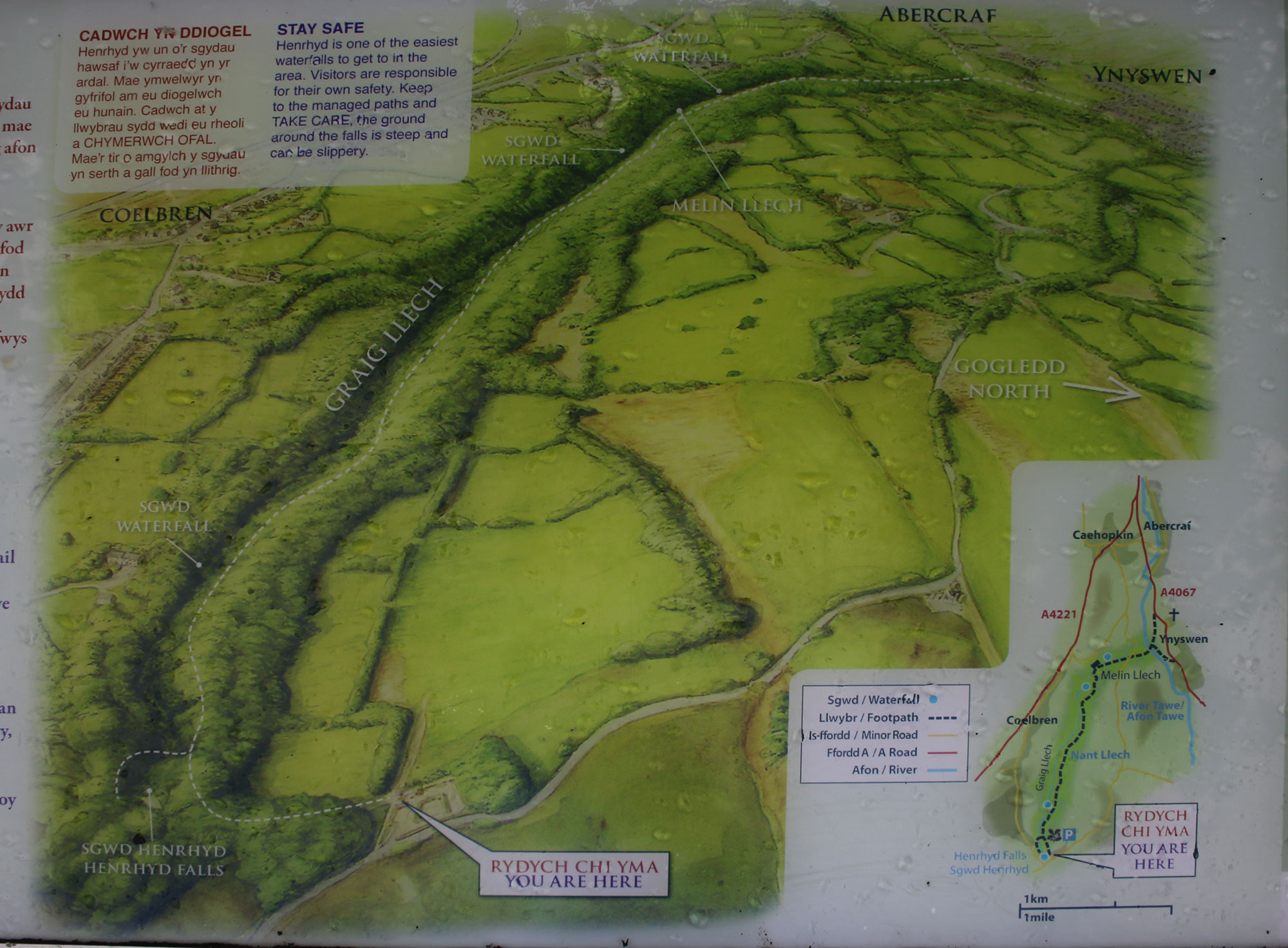
Sgwd Henrhyd is the highest waterfall in south Wales at 90ft, (27 metres). The falls are on the Nant Llech (a tributary of the River Tawe) on the edge of the south Wales coalfield, the layer of sandstone rock at the top is known to miners as the Farewell Rock, when their pick hit this rock, they could say farewell to the coal seam on which they were working. 

The waterfall is famous as a film location, the final scene of the Batman film 'The Dark Knight Rises' was filmed here where the waterfall acts as the curtain of water in front of the batcave. The waterfall scene from the film Robin Hood: Prince of Thieves was also filmed at this location. 


SGWD HENRHYD - THE BATCAVE

Robin standing outside the Batcave at the end of the film  'The Dark Knight Rises'  


Inside the Batcave as depicted in the film 'The Dark Knight Rises'  

THE VIDEO BELOW (LINK TO YOUTUBE) IS THE ENDING OF THE FILM WHICH INCLUDES THE WATERFALL


... ...


Kevin Costner climbs behind the falls in the video of the Bryan Adams chart topping song "I do it for You"


VISITORS TO THE FALLS

WILLIAM LOGAN 1798-1875 

William Logan was born in Montreal, Lower Canada (now Quebec), and educated at the High School in Edinburgh and the University of Edinburgh (graduated 1817). He started teaching himself geology in 1831, when he took over the running of a copper works in Swansea. He produced a geological map of the south Wales coalfield based on this research. In 1840 he presented to the Geological Society of London his paper "On the character of the beds of clay lying immediately below the coal-seams of South Wales, and on the occurrence of coal-boulders in the Pennant Grit of that district." This paper suggested his opinion that the layer of clay under the coalfield was the old soil in which grew the plants from which the coal was formed.

After his retirement in 1869 he settled in Pembrokeshire in west Wales and died at Castell Malgwyn, the home of his sister, Elizabeth Gower. He was interred in the churchyard in the village of Cilgerran.

Logan surveyed the valley in 1838 and removed fossilised trees from the area. These fossils can now be seen outside Swansea Museum.


10-2017-07-13-fossil-tree3.jpg (244198 bytes) Only one fossilised tree can now be seen in front enclosure of Swansea Museum. For more information about Swansea Museum please.......  CLICK HERE


The National Library of Wales archives state under the heading of 'Segillaria' (a type of tree ?) that

"These fossil trees were exposed by William Logan while excavating in the coal measures of Cwm Llech near Coelbren in 1838. He presented them to Swansea Museum, where they still stand, in the garden to the right of the building. It is said that if Mr Logan had the ability to speak Welsh it would have greatly helped him in conversing with miners and local people and there is some evidence that he at least tried to learn the language; he did own a Primer and may have gained a smattering
of knowledge but, although a talented linguist, he had difficulties with Welsh as a comment in his journal showed he found a Canadian Indian language 'nearly as unintelligible' as Welsh. While exploring the region of Cwm Llech, Coelbren, he discovered on 3 April 1833 four vertical fossil trees (Sigillariae). Two of these were donated to the Institution (Swansea Museum)"

Canada's highest mountain Mount Logan (5959mts 19,551ft) is named after William Logan


HOW TO GET THERE

Address: National Trust car park near Coelbren, Brecon Beacons  (The car park is located just outside Coelbren on the minor road to Pen y Cae.)

(Postcode SA10 9PG will get you close enough to the location to allow you to follow the signposts to the car park)

OS Grid ref: SN853121

By train: The nearest main line train station is Neath 18 miles (30km) and a bus can be caught direct to Coelbren from near there. Aberdare train station is 15 miles away and easiest if travelling with a cycle but avoid this route if your onward journey is to be by bus.

By Bus: The X58 service from Swansea and Neath runs every hour during daytime (except Sundays) to Coelbren (1/2 mile/0.75km walk).

By road: From the M4 - Junction 43 - A465 to Glynneath - A4109 signposted Onllwyn - head towards Abercarve on the A4221 follow the brown signposts.

By road: From the Swansea Valley (Swansea to Brecon A4067 road) Signposted from the A4067 at Abercrave and the A4221 by brown tourist signs.

There are no official picnic sites or toilet facilities at the location. 


WALKING TO THE FALLS FROM THE CAR PARK

The walk to the falls from the car park is quite simple. Allow around 30 - 60 minutes for the return journey depending on your level of fitness. The gate to the waterfall can be found in the corner of the car park near the information boards. Follow the path down the steep hill and where it levels out turn left and cross the river on the wooden bridge & steps. Follow the path upriver and you'll reach the waterfall in about 150-200 metres. The path to go behind the fall is a little slippery and tricky but once behind the waterfall the ground is quite solid. Once you have visited the waterfall, you can either retrace your route or take the left hand fork up the hill shortly after start your return journey to the village of Coelbren, once you reach the road, keep turning left and this will bring you back to the car park. Other options are turn right then left again for the village hall where you can buy teas etc in the summer months and the Prices' Arms, the local pub.   


32-general-falls.jpg (703553 bytes) 29-looking-out.jpg (359680 bytes) 30-busy-path.jpg (593919 bytes) 31-general-falls.jpg (483554 bytes)  33-general-falls.jpg (518291 bytes) 34-river-play.jpg (630824 bytes) 35-falling-rocks.jpg (538379 bytes) 36-behind-falls.jpg (480872 bytes) 37-steps.jpg (478280 bytes) 38-path-uphill.jpg (510772 bytes)


LINKS

National Trust website - Nant Llech Walking Trail including Sgwd Henrhyd - CLICK HERE  

Illustrated right the route map and overview of the area from the National Trust information board at the car park

19.jpg (74471 bytes) 18.jpg (464680 bytes) 17.jpg (94177 bytes) 16.jpg (131558 bytes)
   
Wikipedia -   Nant Llech   -   Sir William Edmond Logan   -   Farewell Rock   -   Sgwd Henrhyd
   
Explore South Wales - Henrhyd Falls - CLICK HERE
   
Waymarking - CLICK HERE 


Search the website with Google


HOME