|
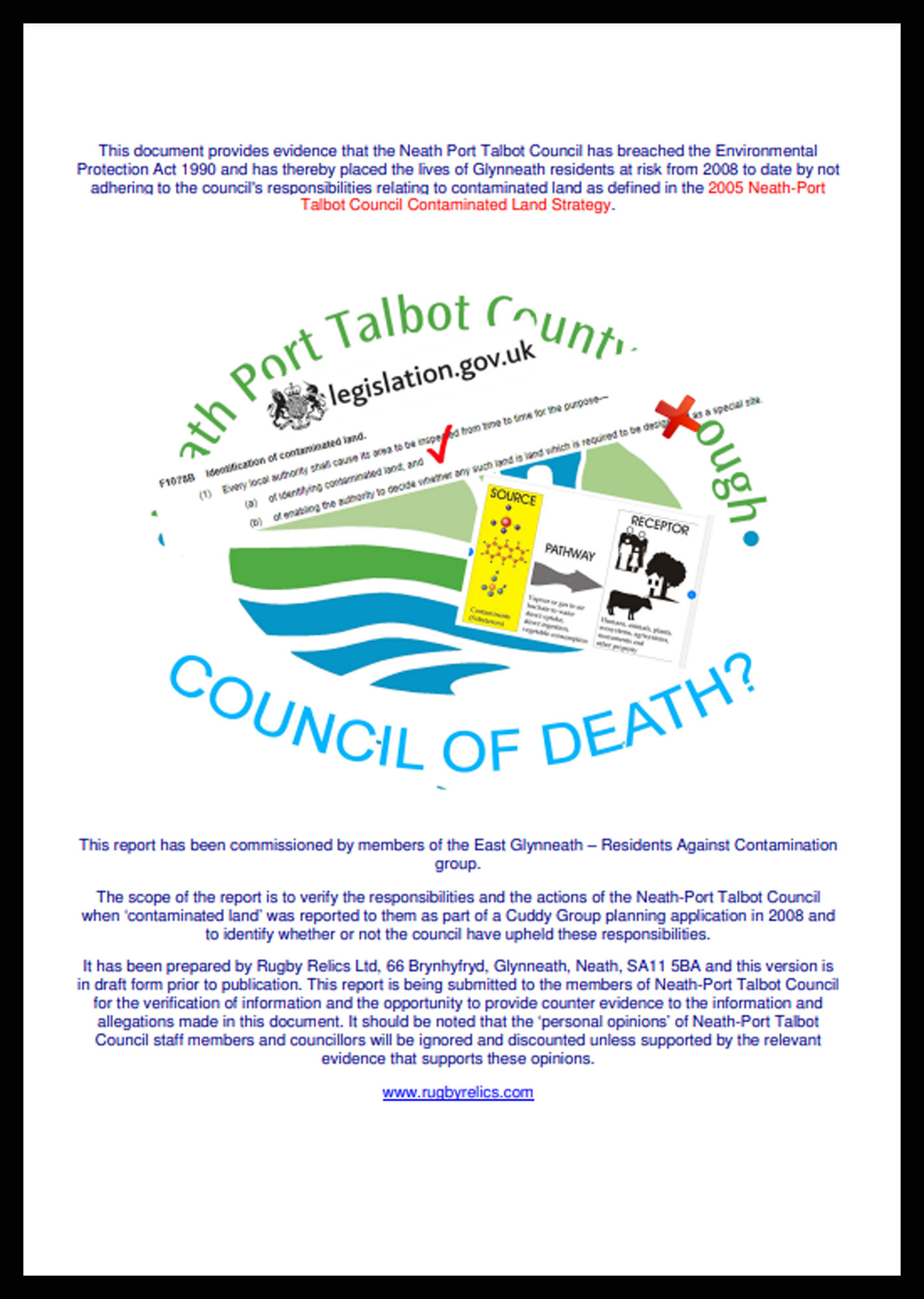
This report has been commissioned by members of the East Glynneath – Residents Against Contamination
group.
The scope of the report is to verify the responsibilities and the actions of the Neath-Port Talbot Council
when ‘contaminated land’ was reported to them as part of a Cuddy Group planning application in 2008 and
to identify whether or not the council have upheld these responsibilities.
It has been prepared by Rugby Relics Ltd, 66 Brynhyfryd, Glynneath, Neath, SA11 5BA and this version is
in draft form prior to publication. This report is being submitted to the members of Neath-Port Talbot Council
for the verification of information and the opportunity to provide counter evidence to the information and
allegations made in this document. It should be noted that the ‘personal opinions’ of Neath-Port Talbot
Council staff members and councillors will be ignored and discounted unless supported by the relevant
evidence that supports these opinions.
www.rugbyrelics.com
PLANNING COMMITTEE MEMBERS
Councillor Suzanne Paddison (Chair) - 249 Western Avenue, Sandfields, Port Talbot, SA12 7NF. -
Phone: 01639 760473 - Mobile: 07891 054074
Councillor Sean Pursey (Vice Chair) - 22 St Pauls Road, Port Talbot, SA12 6PG - Mobile: 07865
355970
Councillor Christopher John Jones, 62 Ynys-Y-Mond, Alltwen, Pontardawe, SA8 3BA, Mobile:
07968 786699
Councillor Dennis Keogh, 35 Wern Road, Port Talbot, SA13 2BD, Mobile: 07967 897072
Councillor Rhidian Mizen, 11 Heol Crwys, Cwmafan, Port Talbot, SA12 9NT, Mobile: 07813
711212
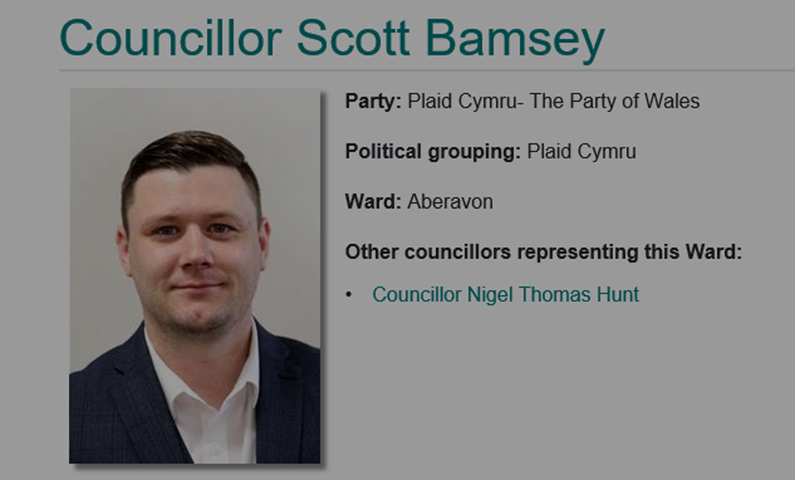
Councillor Scott Bamsey, 7 Wilden Avenue, Port Talbot, SA13 2HS, Mobile: 07478 432532
Councillor Rosalyn Davies, 102 Heol Cilmaengwyn, Cilmaengwyn, Pontardawe, Swansea, SA8
4QN,
Phone: 01792 862447, Mobile: 07989 661280
Councillor Steve K.Hunt, 153 Dulais Road, Seven Sisters, Neath, SA10 9EY, Phone: 01639
700063, Mobile: 07850 429957
Councillor Annette Wingrave (UDP Member (Non-voting)), 9 Pretyman Drive, Llandarcy, Neath,
SA10 6HZ, Phone: 01792 812857, Mobile: 07757 949143,
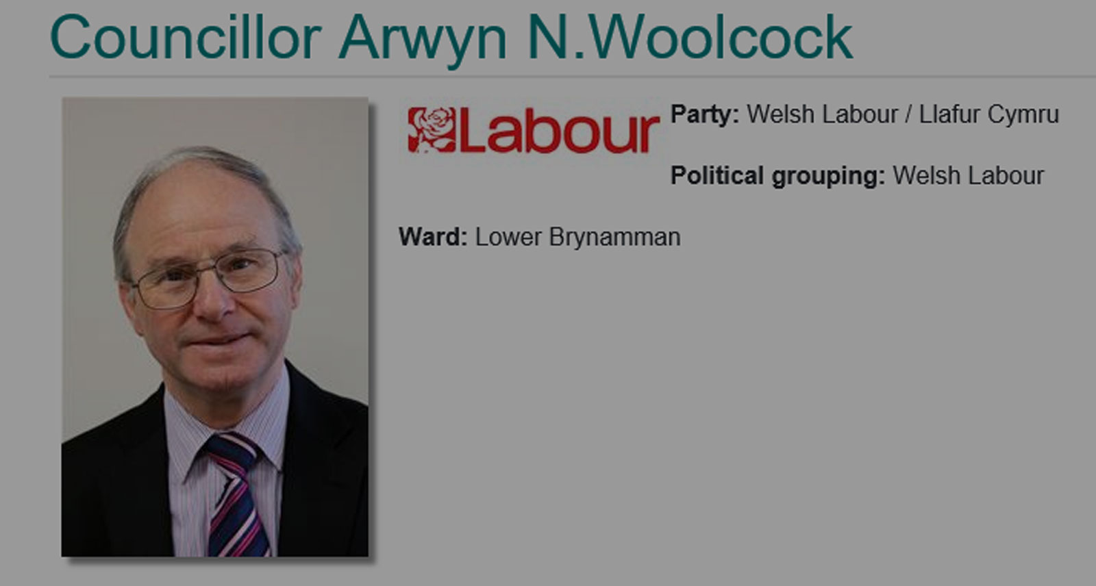
Councillor Arwyn N.Woolcock, 8 Barry Road, Lower Brynamman, Ammanford, SA18 1TU, Phone:
01269 825767, Mobile: 07977 588282
Councillor Chris Williams, 8 Barry Road, Lower Brynamman, Ammanford, SA18 1TU, Phone:
01269 825767, Mobile: 07977 588282
Councillor Susanne Renkes, 65 Pentyla, Baglan Road, Baglan, Port Talbot, SA12 8DR, Phone:
01639 897818, Mobile: 07932 377022
Councillor Mark Protheroe, 64 Harle Street, Neath, SA11 3DL, Phone: 01639 769231
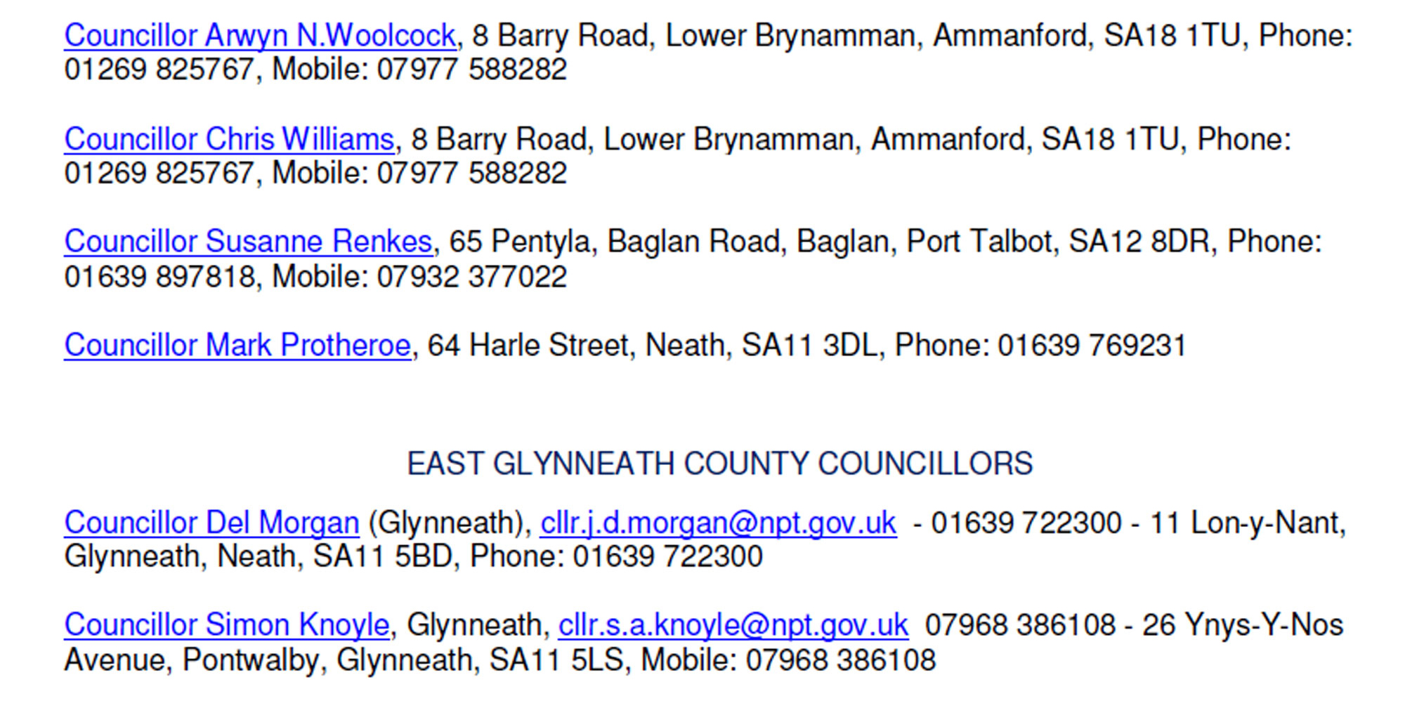
EAST GLYNNEATH COUNTY COUNCILLORS
Councillor Del Morgan (Glynneath), cllr.j.d.morgan@npt.gov.uk - 01639 722300 - 11 Lon-y-Nant,
Glynneath, Neath, SA11 5BD, Phone: 01639 722300
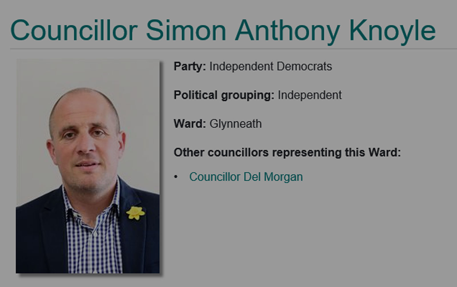
Councillor Simon Knoyle, Glynneath, cllr.s.a.knoyle@npt.gov.uk 07968 386108 - 26
Ynys-Y-Nos
Avenue, Pontwalby, Glynneath, SA11 5LS, Mobile: 07968 386108
Firstly we should refer to the Purpose, Vision and Values of the Neath-Port Talbot Council to establish a
base-line for the actions and accountability of Neath-Port Talbot Council staff and councillors:
“Our Purpose: Neath Port Talbot County Borough Council exists to serve and represent the interests of its
citizens and communities. We strive to improve the economic, social, environmental and cultural well-being
of all of our people.
Our Vision: We want our county borough to be a place where everyone has an equal chance to get on in life
– a place where people want to live, learn and work and bring up their family.
We want our beautiful natural environment, and our rich cultural and industrial heritage to be appreciated
and protected for many future generations to enjoy.
We also want to pursue new and existing opportunities for economic growth so we can sustain our diverse
communities for many years to come.
Our Values: We will stand up for our citizens and our communities, advocating for the needs and aspirations
of our people in every aspect of our work.
We will listen to our citizens, our workforce and our many partners and seek ways to meaningfully involve
people in our work.
We will celebrate diversity in all of its forms and work tirelessly for greater equality in all of our communities.
We will conduct the work of the Council in an open and accessible way, ensuring we are properly
accountable for the decisions we make.
We will make the best use of all resources available to us.
We will be open to challenge and will promote a culture of learning and innovation throughout our
organisation.
We will further strengthen the bonds of collaboration, working with others – including the voluntary, statutory
and private sectors to benefit our citizens and communities.”
……………and an extract from the NPTC staff code of conduct.
“Any breach of the Council’s Employee Code of Conduct is a potential disciplinary offence, which will be
dealt with in accordance with the Council’s Disciplinary Procedure, and which can lead to the dismissal of
the employee(s) concerned. A breach of the Code may also constitute a criminal offence.
The public is entitled to expect the highest standards of conduct from all employees of Neath Port Talbot
County Borough Council. The role of such employees is to serve the Authority in providing advice,
implementing its policies, and delivering services to the local community. In performing their duties, they
must act with integrity, honesty, impartiality and objectivity.”
The East Glynneath – Residents Against Contamination Group are able to provide evidence that the Neath-
Port Talbot Council have failed to observe the purpose, visions and every single value contained in the
Neath-Port |Talbot Council Corporate Plan. They are able to provide evidence that the staff ‘code of
conduct’ has been breached on many occasions. Documents containing these allegations are currently in
preparation.
Land south of Heol y Glyn Site History / Background
Historically the land south of Heol y Glyn has been used for the last 80+ years as a landfill site, both
municipal and industrial. Long term residents of the area always refer the site as 'the ash tip' because of the
prominence of ash deposited there or plainly 'the tip'. These residents include:
Maureen Llewellyn who was born in 1938 and has always lived in Woodland Park (within 100 metres of the
‘tip), she can remember the site as a tip during her childhood,
Pam Thomas who has lived in Woodland Park since 1960,
Jane Powell who has lived in Brynhyfryd for 51 years and whose uncle George Anton was a refuse collector
at the ‘tip’ in the early 1950s,
Jennifer Woodward of Brynhyfryd has lived overlooking the tip for the last 50 years
Ray Jones, Glynneath resident whose father worked on the tip. Ray's father was the ash cart driver, circa
1940 and Ray is of the opinion that Neath Rural District council took over the tip about then.
The land was sold and has been in private ownership for approximately 50 years. Planning permission for a
housing development was first granted in 1989. The land was eventually acquired by the Cuddy Group Ltd.
The Cuddy Group used the 'tip' for their main line of business which was demolition and remediation
including asbestos removal. In 2003 the Cuddy Group submitted plans to build houses on the site. These
plans were approved by Neath-Port Talbot Council in 2005. Cuddy continued to tip on the site without
consideration to any future development, in 2017 a residents action group concerned about an Aberfan style
tip looming above their houses successfully ended the Cuddy tipping with the aid of local councillors.
There is no evidence of groundwork for a housing development having taken place and there is no evidence
that the Cuddy Group intended to build houses. The housing brand “Primrose Homes” set up by the Cuddy
Group did not build a house during the entirety of its existence and it is generally accepted locally that the
housing development proposed by Cuddy was a front for the illegal tipping of asbestos and toxic waste.
Several residents have witnessed what they believe to be asbestos tipped on the site while others have
noted what they believe to be barrels of chemical waste on the site. The photographic evidence available
supports this theory.
Contaminated Land Identified and information submitted to NPTC on 26/11/2008
In 2008 the Neath-Port Talbot Council was informed that the land was contaminated. There is no evidence
that this information was acted upon which was a requirement of the 1990 Environmental Protection Act.
The Cuddy Group attempted to meet condition 17 (access road borehole testing) imposed by the council
planning department. Part of the condition was that a "Geotechnical Survey" of the ground be submitted.
A Geo-technical and Geo-environmental report was submitted to the council planning department on the 26
November 2008. This was prepared for Moore Knight Limited by Terra Firma (Wales) Limited. The report
found that of the 6 soil samples sent for chemical testing, 4 tested above the recognised safe levels for the
presence of recognised contaminants A source to receptor linkage was shown by the report, therefore the
land was designated as contaminated by the surveyors who provided the Neath Port Talbot Council with this
evidence and a suggested Remediation Strategy.
Two of the contaminants were grade 1 classified carcinogens Arsenic and Benzo[a]pyrene. The remediation
strategy also included, suggested that an 'asbestos waste removal' licence be obtained. This information is
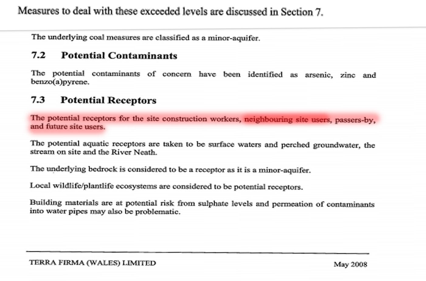
contained in the illustration below taken from the survey available in the planning department archives.
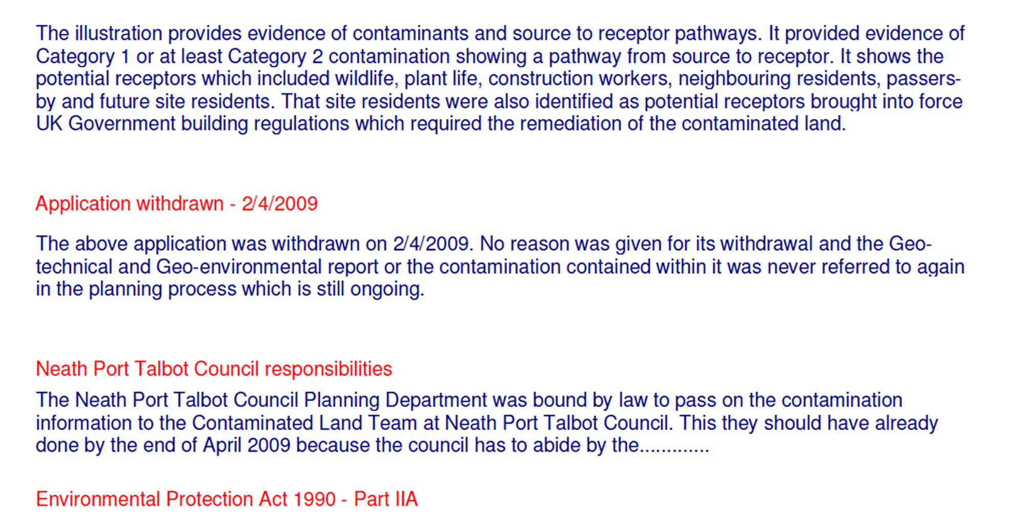
The illustration provides evidence of contaminants and source to receptor pathways. It provided evidence of
Category 1 or at least Category 2 contamination showing a pathway from source to receptor. It shows the
potential receptors which included wildlife, plant life, construction workers, neighbouring residents, passersby
and future site residents. That site residents were also identified as potential receptors brought into force
UK Government building regulations which required the remediation of the contaminated land.
Application withdrawn - 2/4/2009
The above application was withdrawn on 2/4/2009. No reason was given for its withdrawal and the Geotechnical
and Geo-environmental report or the contamination contained within it was never referred to again
in the planning process which is still ongoing.
Neath Port Talbot Council responsibilities
The Neath Port Talbot Council Planning Department was bound by law to pass on the contamination
information to the Contaminated Land Team at Neath Port Talbot Council. This they should have already
done by the end of April 2009 because the council has to abide by the.............
Environmental Protection Act 1990 - Part IIA
Council regulations for contaminated land in 2008 were contained in the 2005 NPTC Contaminated Land
Strategy. This document states that:
"Part IIA of the Environment Protection Act 1990, was introduced in Wales on July 1st 2001, until this time
there had been no strategic approach to the identification of contaminated land. Land contamination had
always been addressed during redevelopment or when the risk has manifested itself. Since 2001, all local
authorities have a duty to inspect their areas, locate and ensure the remediation of all statutory designated
contaminated land. One of the key objectives of the council's strategy (Key Objective 4:) is to ensure
that during the redevelopment of new sites, land contamination issues are dealt with effectively and
at an early stage of the planning process."
The focus element of this statement is that the document says that the contamination should have been
dealt in the early stages of the planning process………..
………..One of the key objectives of the council's strategy (Key Objective 4:) is to ensure that during
the redevelopment of new sites, land contamination issues are dealt with effectively and at an early
stage of the planning process."
If we refer again to the..................
Environmental Protection Act 1990 - Part IIA
........Identification of contaminated land.
The opening points of which are................
(1) Every local authority shall cause its area to be inspected from time to time for the purpose—
(a) of identifying contaminated land; and
(b) of enabling the authority to decide whether any such land is land which is required to be designated as a
special site.
The presence of Benzo[a]pyrene (BaP) in the soil at above a safe level as identified by the Geo-technical
and Geo-environmental report would indicate that the land is contaminated.
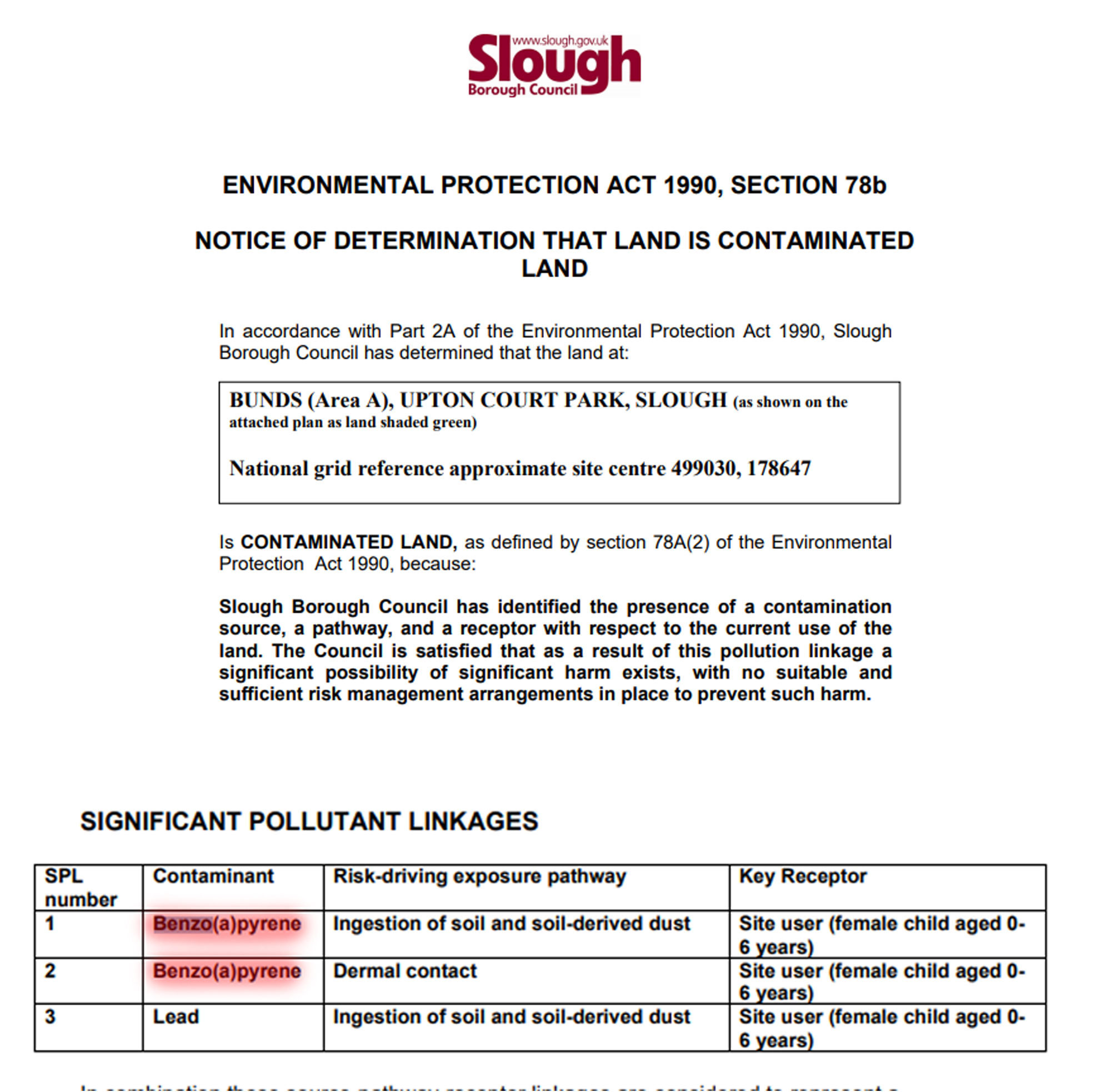
If we look at the following examples of councils in England, both Reading and Slough who have discovered
BaP in soil within their authority, we will see that an above level of the contaminant Benzo[a]pyrene with a
source to receptor pathway included is considered enough for these sites to be designated as
'contaminated' and for the land to be referred to the Environment Agency. At this point in time (2009) the
Environment Agency was also the governing body for contaminated land in Wales so a similar process
should have been undertaken by the Neath Port Talbot Council.
SLOUGH CONTAMINATION
This is an extensive document; this information can be found on-line at:
http://walk-around-wales.com/county/npt/glynneath/enzo-development/info-other/20200609R-DO-sloughcontam-
bap.pdf
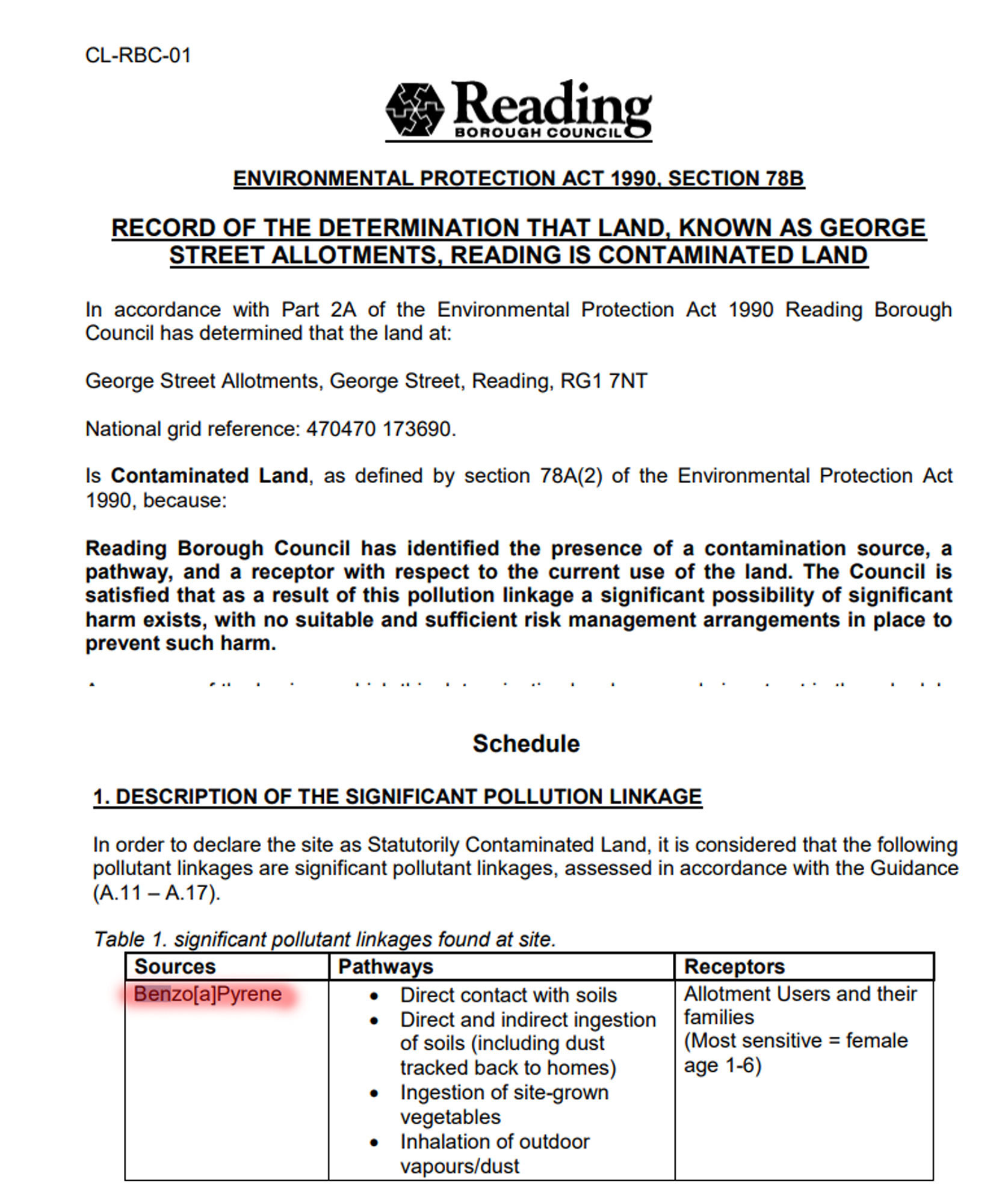
READING CONTAMINATION
This is an extensive document; this information can be found on-line at:
http://walk-around-wales.com/county/npt/glynneath/enzo-development/info-other/20200609R-DO-readingcontam-
bap.pdf
The Reading site in particular is of importance because the contamination could be considered to be of a
similar nature to the Heol y Glyn site. The contamination at Heol y Glyn is not necessarily a modern one.
The contamination at Reading was identified as most likely being from the tipping of domestic ash. If we
refer back to the historical usage of the site we will see that it was known as the 'ash tip' and was at one
time the local council tip. With coal fires being the predominant method of heating (and possibly cooking in
some cases) in a coal mining area, it is probable that the majority of landfill at the site was domestic ash.
The Reading document states that:
[the contamination] is considered more likely to be related to historical use of the site as allotments or
possibly the previous use of the land as open ground at the rear of houses that may have been used for
domestic ash disposal." - 20200609R-DO-reading-contam-bap
In a document dated 2009 “Dealing with contaminated land in England and Wales” to which the Neath-Port
Talbot Council contributed research material, the Environment Agency state that”
The waste management and energy industries were often reported as causing contaminated land sites in
England. In Wales, other types of activities (for example the deposit of ash) was reported to cause
contamination at the majority of contaminated land sites. For special sites, chemical and waste
management industries are associated with causing contamination.”
The land had previously been an ‘ash tip’ and as the tipping site for one of the world’s largest demolition and
waste management companies. As a contributor to the document the Neath-Port Talbot Council would have
been aware that there were two indicators in place for contamination at the site.
If we look again at the "Neath-Port Talbot Council's 2005 Contaminated Land Strategy" which was the
document the planning department should have referred to for guidance on contamination, what should
have happened is that the Planning Department should have passed the contamination information on to
Contaminated Land Team (CLT), the CLT who should have then either informed the Environment Agency or
worked with the Planning Department to formulate a remediation strategy. This is what the document
says..........
"When considering development proposals, the planning authority’s role is to ensure that all material
planning considerations, which can include the actual or possible presence of contamination, are
satisfactorily addressed. When considering an application, where contaminated land is involved the planning
authority will identify specific measures to be undertaken prior to redevelopment, these requirements will be
imposed by a set of conditions attached to the planning permission. The main objective of the conditions is
to ensure suitable investigation work is carried out and that the land is remediated to a standard that is
suitable for the proposed end use."
Page 36 of this document which covers the planning process states that sites that may be contaminated
should be identified at the earliest stage of the planning process and then throughout the development stage
and that there should be "close liaison between the Contaminated Land Officer and the Planning Officer".
There is no evidence of any liaison between these two departments between 2008 and 2010 and the Neath
Port Talbot Council refuse to provide evidence of any liaison or of any actions relating to the contamination
identified in the 2008 report.
The overall aim of the Contaminated Land Strategy in 2008 was............
"........to identify, remove and prevent significant harm occurring from contaminated land to people, property,
animals and the environment" (page 15)
Evidence of contaminated land
The Geo-technical and Geo-environmental report submitted by the Cuddy Group Agent on 26 November
2008 included a pollutant linkage (source ---> pathway ---> receptor) from the site to construction workers,
neighbouring residents and future site residents. This would indicate either a Category 1 (probable
significant harm) or Category 2 (possible significant harm) contamination which would require further testing
and a remediation strategy.
It should be noted that the maximum depth to which the contaminated land was tested was only 1.4 metres.
The tipped material at the site in some places goes down to approximately 20 metres at a conservative
estimate. It is therefore highly likely that a far higher level of contaminants could be found at the lower levels
of the site on the basis of its historical use as an ash tip.
The fact that the report included a remediation strategy and validation report is clear evidence the surveyors
considered the level of contamination to be either Category 1 or Category 2.
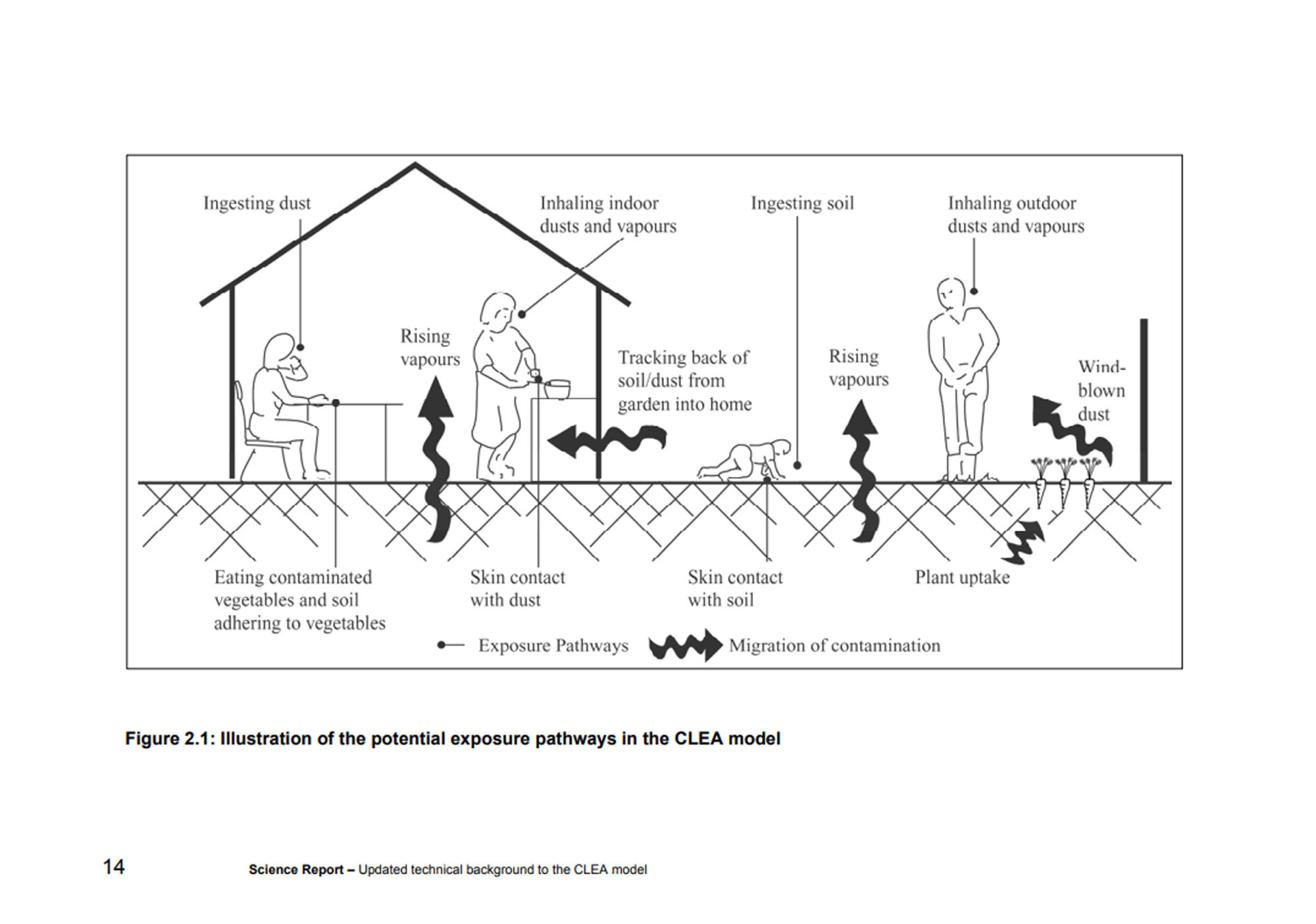
Figure 2.1, the illustration above is from the Environment Agency publication "Using Science to create a
better place - Updated technical background to the CLEA model" it shows the potential exposure pathways
for the migration of contamination from soil to human. The figure on the right showing a man working in the
garden is particularly relevant to the Heol y Glyn site.
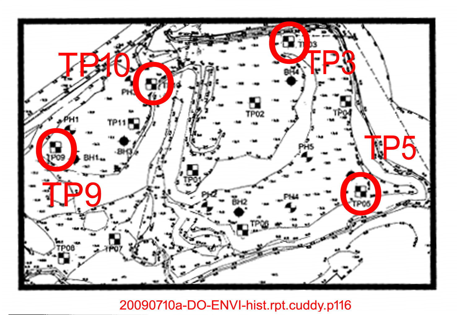
The land was found to be contaminated at points TP3, 5, 9 and 10 (see illustration above with the majority
of those points all being close to the edge of the development and near to local residents properties. In
some instances, the contaminated land testing site can be found less than 20 metres from a neighbouring
property. The report advised that dust suppression and a boundary fence were necessary to keep the
contaminants from affecting local residents, but since this report was withdrawn and the contamination left
unremediated, dust and vapours have been regularly blown towards the houses of residents living next to
the site while the Cuddy Group tipped industrial waste. This dust has affected the health of some residents,
several of whom have asthma, there are also incidences of children born with mutations and young adults
dying from cancer. Some of these young adults used the area of the site known locally as ‘the bog’ as a play
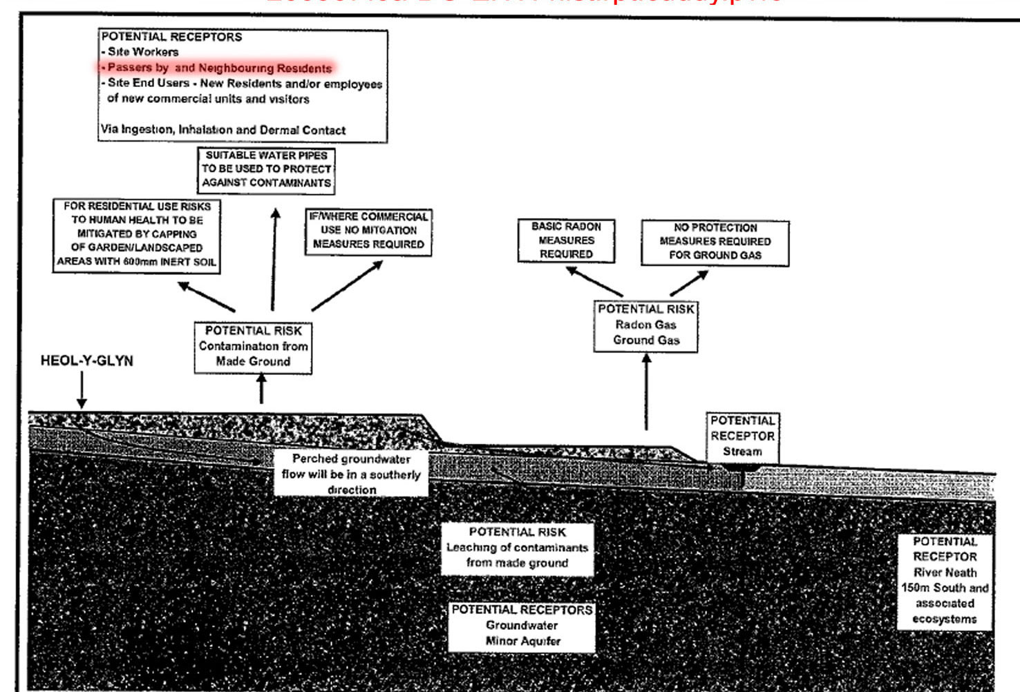
area during childhood. The figure below shows the direction of the ground water flowing downhill toward the
stream and wetlands area of the development site. Water in the bog area would have flowed down from the
tipped material at the site and it is probable that this ground water contained contaminants as identified in
the 2008 survey.
The illustration above shows the direction of groundwater which probably contained contaminants. This
groundwater flowed downhill to Brynhyfryd and Woodland Park and has also possibly contaminated home
grown produce.
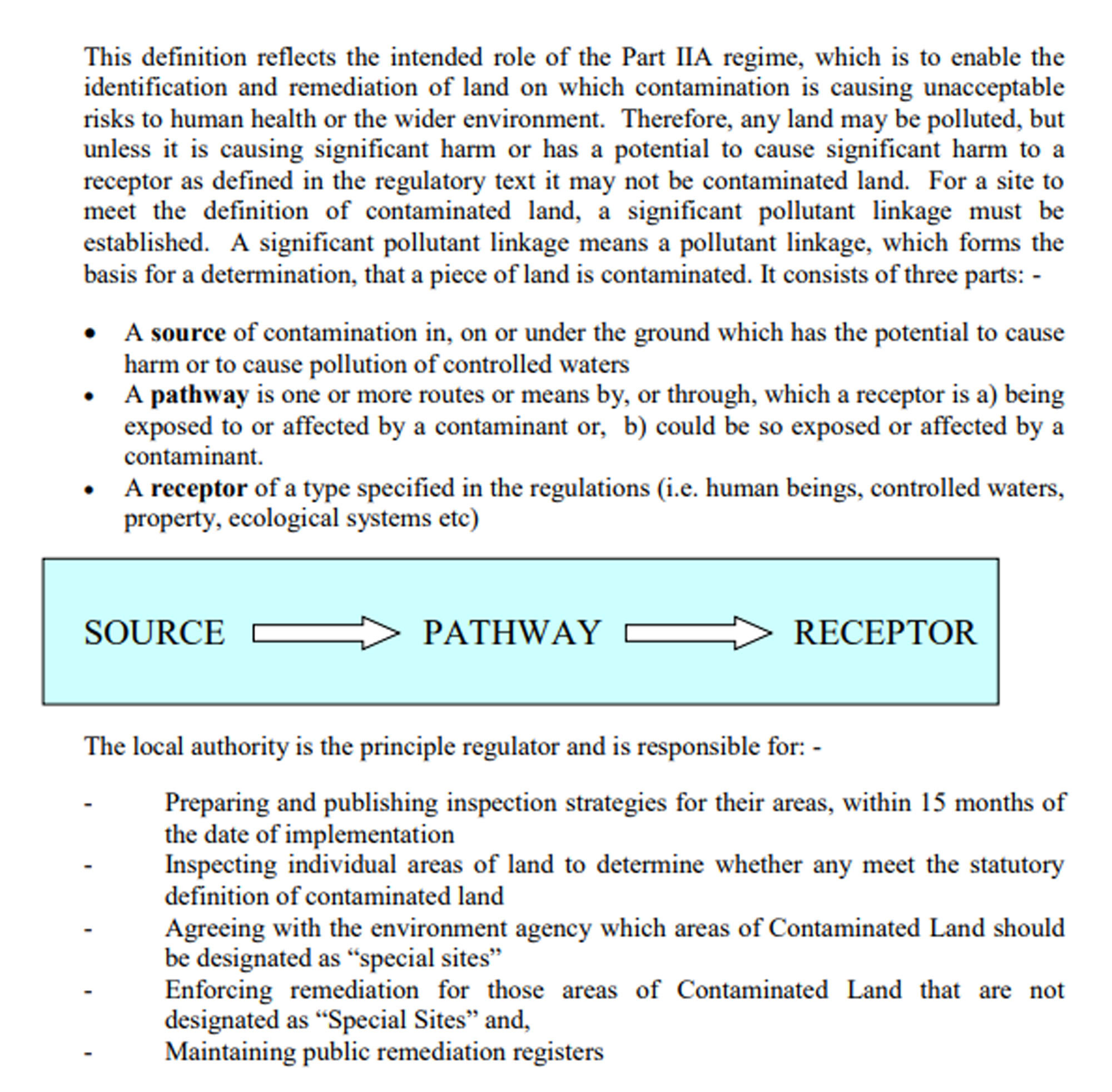
The illustration below shows an overview of the Source – Pathway – Receptor system. This appears in this
document for information purposes only.
The following image is an extract from the Neath-Port Talbot Council 2005 Contaminated Land Strategy
showing a simpler path to receptor method of identifying contaminated land together with the council’s
responsibilities:
(Page 7 - NPTC 2005 Contaminated Land Strategy)
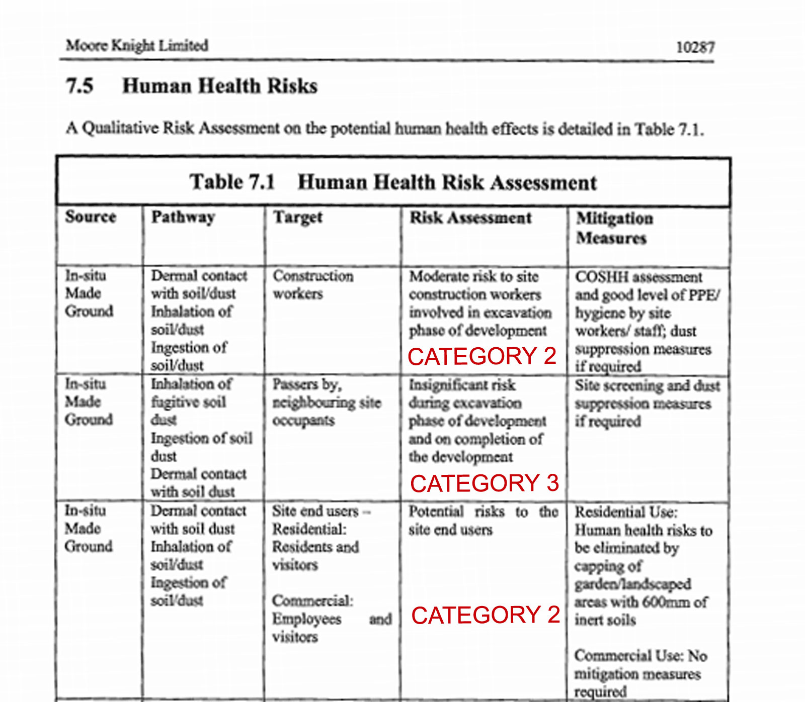
The above image shows the “Human Health Risk Assessment” source to receptor pathway supplied to the
Neath Port Talbot Council in 2008. The suggested remediation of the capping of garden landscape areas for
the ‘site end users’ (future residents) is clear evidence of contaminated land. If we refer to the Environment
Agency document “Dealing With Contaminated Land in England and Wales” published in 2009 we will see a
direct reference to this form of remediation on this type of land under Part II of the Environment Act.
“Under Part 2A, remediating a site does not necessarily mean the source of contamination has to be
removed. (for example, capping an old landfill).”
That a pollutant linkage from the source at the Heol y Glyn site to human receptors, construction workers,
future residents and neighbouring residents was identified, places the contamination as either Category 1
(probable significant harm) or more likely Category 2 (possible significant harm). The inclusion of this
information in the Geo-technical and Geo-environmental report provides evidence that the land should have
either been remediated by the imposition of conditions, the polluter pays principle or passed on to the
Environment Agency for further testing to identify whether or not it is a special site.
If we refer again to the Environmental Protection Act 1990 (b).
(b) of enabling the authority to decide whether any such land is land which is required to be designated as a
special site.
There is no evidence that the Neath-Port Talbot Council investigated the contaminated land to decide
whether or not it was a special site. Their failure to do so breaches this act.
What did happen?
What is clear is that the Neath Port Talbot Council Planning Department colluded with the Cuddy Group to
hide the contaminated land, this constituted a breach of the 1990 Environmental Protection Act, and was
done in a 4 step process. This evidence can be found on the Neath-Port Talbot Council planning website.
Step 1 – Contamination information withdrawn - The planning application containing the contaminated land
information was withdrawn on 2/4/2009. No reason was given for its withdrawal. The Geo-technical and
Geo-environmental report or the contamination contained within it was never referred to again in the
planning process until discovered by the East Glynneath – Residents Against Contamination group in March
2020.
Step 2 – New agent appointed by Cuddy - In 2010, the Cuddy Group appointed a new agent (Asbri
Planning) to submit new planning information.
Step 3 – Land redefined - The plans previously submitted in 2008 stated that historically there was no tip or
industrial activity at the site, the 2008 application said the land had previously been open fields. The 2010
planning application submitted by the new agent redefined the land as a 'brownfield', this would suggest
that any contamination at the site would have been dealt with. (There is no evidence of the NPTC Planning
Department referencing the land as 'brownfield' in any document, their definition of the land can be found in
the Local Development Plan where it is described as 'gently sloping’.) The Cuddy Group used the term
‘brownfield’ in documents submitted to the planning department. The documents were accepted by the
planning department and so they must clearly have been aware of the change in land status from ‘open
fields’ to ‘brownfield’.
Step 4 - Full conditions for the 2010 approval are included on the Neath Port Talbot Council planning
website. If there was remediation to be done at the site in line with the Contaminated Land Strategy then it
would be included as one of the conditions here. There is no mention of contaminated land, neither is there
is a mention of testing for contamination or of remediation of the identified contamination in the conditions.
The contamination identified in the 2008 survey is now contained in the ‘brownfield’ status.
By allowing the Cuddy Group to re-define the land as 'brownfield' and by introducing changes to condition
17. The changes allow the Cuddy Group to submit a new Geotechnical survey, this was eventually
submitted in 2016 without reference to chemical testing. The survey was by a different company to that
which undertook the 2008 survey. Allowing a new survey as part of the conditions without chemical testing
also suggests that the planning department wanted the previous survey containing the contamination
hidden.
The changes to condition 17, allowing Cuddy to re-define the land as ‘brownfield’, the allowance of a new
Geotechnical survey and the failure to address the contaminated land through conditions provide evidence
that the NPTC Planning Department were working together with the Cuddy Group to hide the contamination
in order to bypass the remediation process.
The result of the above 4 step process was that Neath Port Talbot Council Planning Department succeeded
in hiding the fact that the land had been tested as contaminated until the East Glynneath – Residents
Against Contamination group discovered it in the planning archives in March 2020.
These documents contained on the Neath Port Talbot Council’s website provide clear evidence that the
Neath Port Talbot Council received evidence that a source to receptor pathway existed at the Heol y Glyn
site and the land was defined as contaminated. The Neath-Port Talbot Council failed to act on this
information as required at the time by UK Government law, therefore they have broken the............
Environmental Protection Act 1990 - Part IIA
(b) of enabling the authority to decide whether any such land is land which is required to be designated as a
special site.
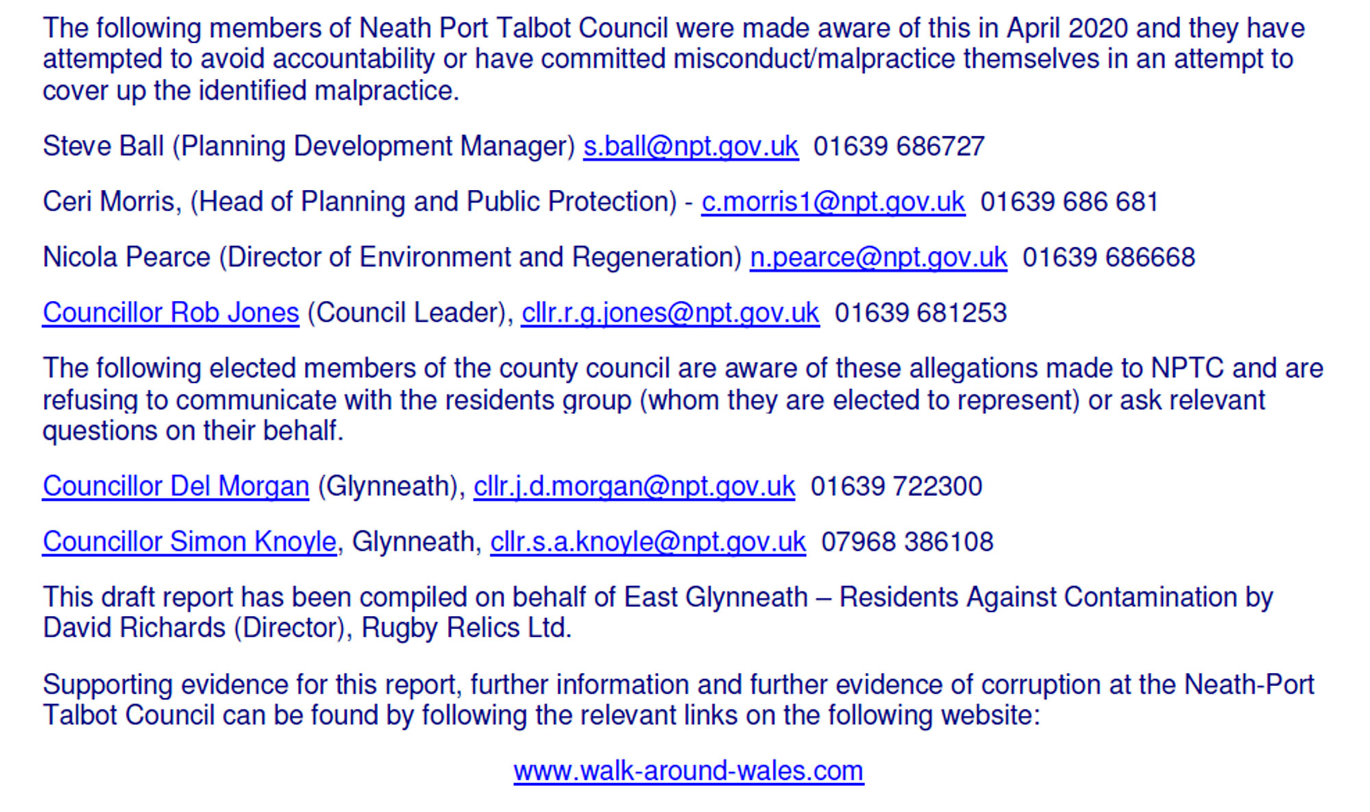
The following members of Neath Port Talbot Council were made aware of this in April 2020 and they have
attempted to avoid accountability or have committed misconduct/malpractice themselves in an attempt to
cover up the identified malpractice.
Steve Ball (Planning Development Manager) s.ball@npt.gov.uk 01639 686727
Ceri Morris, (Head of Planning and Public Protection) - c.morris1@npt.gov.uk 01639 686 681
Nicola Pearce (Director of Environment and Regeneration) n.pearce@npt.gov.uk 01639 686668
Councillor Rob Jones (Council Leader), cllr.r.g.jones@npt.gov.uk 01639 681253
The following elected members of the county council are aware of these allegations made to NPTC and are
refusing to communicate with the residents group (whom they are elected to represent) or ask relevant
questions on their behalf.
Councillor Del Morgan (Glynneath), cllr.j.d.morgan@npt.gov.uk 01639 722300
Councillor Simon Knoyle, Glynneath, cllr.s.a.knoyle@npt.gov.uk 07968 386108
This draft report has been compiled on behalf of East Glynneath – Residents Against Contamination by
David Richards (Director), Rugby Relics Ltd.
Supporting evidence for this report, further information and further evidence of corruption at the Neath-Port
Talbot Council can be found by following the relevant links on the following website:
www.walk-around-wales.com
|