|
GLYNNEATH & PONTWALBY CIRCULAR WALK - 2.3 miles |
|
|
GLYNNEATH-PONTWALBY-CIRC-2UO-SN.883064.SA11.5DB GARMIN - ROUTE IMAGE (TO FOLLOW) - PRINTABLE DIRECTIONS (TO FOLLOW)
|
|
|
DISTANCE 2.3 miles
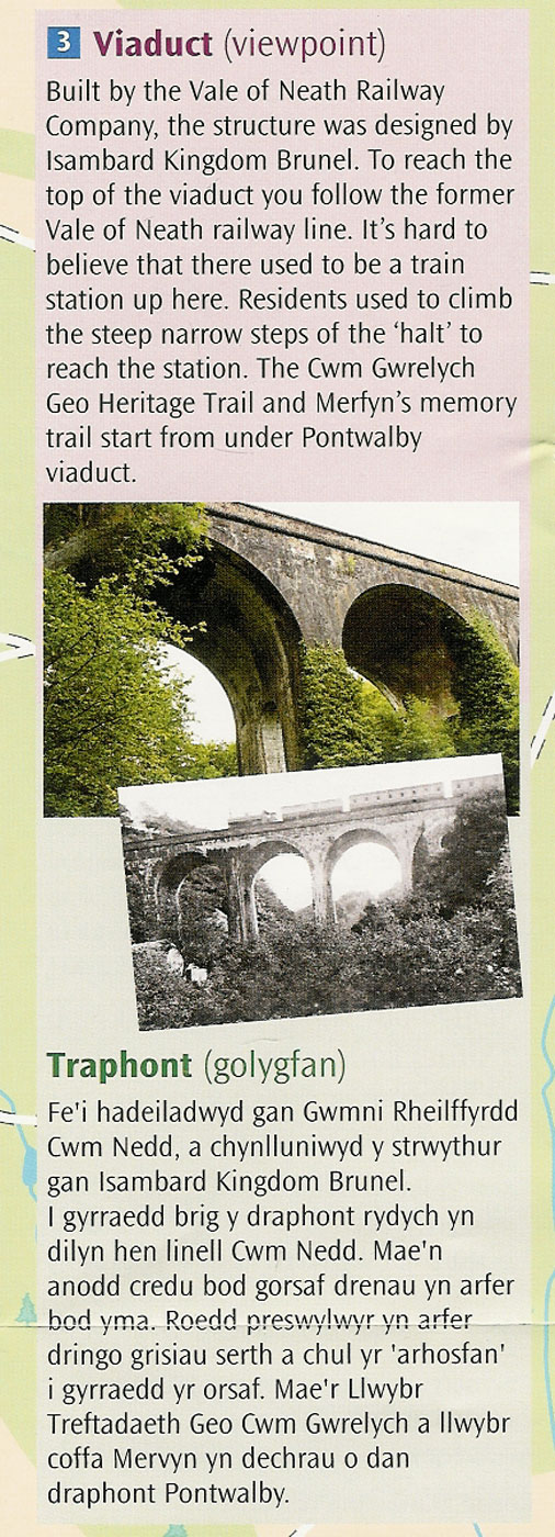
ELEVATION - Undulating - 248 feet SEVERITY of TERRAIN - Off Road (muddy in parts) START - Glynneath Town Centre Car Park GRID REF - SN 883 064 POSTCODE - SA11 5DB (Oddfellows Street) PLACES OF INTEREST - Pontwalby Viaduct LAST WALK UPDATE - 17 Dec 2015 WALK BLOG & MORE PHOTOS - CLICK HERE DIRECTIONS TO START - Drive through Glynneath town until you reach the Co-operative Supermarket - turn into Oddfellows Street opposite (signposted P = parking) the Co-op and follow it to the end. OVERVIEW - A nice circular walk focussing on the Pontwalby Viaduct built by Isambard Kingdom Brunel. This walk can be extended to take in the Cwm Gwrelych Geo-Trail
|
CLICK HERE FOR A MORE DETAILED IMAGE OF THE ROUTE (TO FOLLOW)
|
CLICK HERE FOR A MORE DETAILED IMAGE OF THE ROUTE (TO FOLLOW)
|
THE WALK ON GARMIN
|