HOME  -  DAI'S BLOG HOME


DAI'S WALK-AROUND-WALES BLOG - JULY 2017


6 July 2017 - HW - NPT TOUR LEG 23 - OGWR RIDGEWAY to MARGAM MOUNTAIN

It's been a couple of months since our last HW NPT tour and I've lost count what number leg this is but today was really nice so we headed off where we left the Ogwr Ridgeway walk on our last outing. Originally the walk was due to be about 10 miles but with the sun's rays burning down on us a shorter route was chosen. My garmin was left behind so I have to estimate the actual distance covered which is around 4 miles. We did a straight out and back course to an old enclosure above Margam Park. The most noticeable thing about the walk was that the Himalayan Balsam has taken a real hold in not only the hedges but some of the fields as well. This invasive species spreads by seed and it is taking over Wales. It is a real problem.
  
15.jpg (482789 bytes) 14.jpg (494023 bytes) 13.jpg (717841 bytes)
The dreaded balsam The dreaded balsam Baby balsams gathering for the invasion


11.jpg (504514 bytes) 16.jpg (473913 bytes) 17.jpg (972735 bytes)
Ogwr Ridgeway path Ogwr Ridgeway path I have these pink flowers growing in my garden and would love to know what they are called.


8 July 2017 - FERRY BEND


A ton of jellyfish have been washed up this year, this one came up the river and there were lots of little fishes beaching themselves on the tideline. They were only about 2 inches long and darted here and there and then onto the beach. 

13 July 2017

10-2017-07-13-fossil-tree3.jpg (244198 bytes) We popped over to Swansea for some shopping but took time out to walk from the Kilvey Hill car park to Swansea Museum to see the fossilised trees that were found in Cwm Llech below the Henrhyd waterfall. 

For more about the waterfall and these this valley please CLICK HERE


14 July 2017 - WALK AROUND WALES - MONTGOMERY to WELSHPOOL

30.jpg (342507 bytes)

It was back onto the Offa's Dyke path for the long running Walk Around Wales saga, this is the 7th year now and I'm about one third of the way into the walk and two thirds of the way up the Offa's Dyke path. 

For more info on today's walk please click the link below:

OFFA'S DYKE - MONTGOMERY to WELSHPOOL


16 July 2017 - SUNSET ON ABERAVON BEACH


Sunset was again a lovely deep orange. The above photo was taken 5-10 minutes before sunset and the one below about 10 minutes after. There was no wind and the air was warm, another fantastic stroll on the tideline with Mrs Dai's Blog. The dog in the picture below entertained us for about 5 minutes chasing seagulls.  


18 July 2017 - Simon Thomas MSc

05-dad-hat.jpg (327323 bytes)

Our little boy Simon graduated in St David's Hall, Cardiff today with a masters degree in chemistry so we walked around Cardiff a little, watched the presentation, had some photos taken etc etc. We are proud parents indeed.

Watch Simon as he walks across the stage - CLICK HERE


99.jpg (281519 bytes)

23 July 2017 - Sunset on Aberavon Beach

It was off to the beach for another amazing sunset. There were a full range of colours this evening from orange to pink, red then purple, with the tide receding there was a nice reflective surface to capture the colours.

04-clouds3.jpg (139323 bytes) 03-hayley1.jpg (130826 bytes) 02-legs2.jpg (186998 bytes) 01-sunset6.jpg (157578 bytes)


24 July 2017

The weather looked good for another nice sunset so we couldn't resist another walk on the beach

98-splash4.jpg (159564 bytes) 97.jpg (202279 bytes)

25 July 2017

Back on the beach at 7.30 for a swim and I touched 3 of those jellyfish including the one that swam straight into my leg. Arrrrgghhhh

27 July 2017 - St Illtyd's Walk

St Illtyd's Walk is a 64 mile long distance walk between Margam and Pembrey. Saint Illtyd was a well respected 7th century saint, the trail follows a route that St Illtyd is believed to have travelled whilst preaching in South Wales. The trail links with other long distance routes in south Wales including the Coed Morgannwg Way, Wales Coastal Path and the Ogwr Ridgeway Walk. St Illtyd lived in the latter part of the 5th and early part of the 6th century. He was held in high veneration in Wales being the founder and abbot of Llanilltud Fawr (Llantwit Major) in the Vale of Glamorgan. 

Today I braved the elements and made a start on St Illtyd's Walk travelling east to west on the trail. Margam Park to Pembrey. The plan is to complete the walk in circular routes of between 6 and 12 miles depending on the logistics of where to park. The first leg however didn't go to plan as the map and the physical route differed. See below for more info.

CLICK HERE FOR MORE ON ST ILLTYD'S WALK  

HW NPT TOUR LEG 24 - MARGAM MOUNTAIN to MARGAM ABBEY (completed 27 July 2017) - 6.17 miles - 919 ft elevation

The above OS reference is a general one for Margam Park so it made sense to start the walk at Margam Abbey and the Margam Stones Museum. Knowing the area very well, I didn't look for a start sign and didn't ask either so I'm not sure if one exists or not. I assumed that the walk started at the Abbey ? Leaving the Abbey I headed out onto the road and behind Margam Castle. Using an OS map to navigate I followed what I thought was the correct route for the walk. Unfortunately the map was either an old one or wrongly marked because the signposted route I realised on my way back follows the same route as the Ogwr Ridgeway. Confused ? Let me show you what I mean.

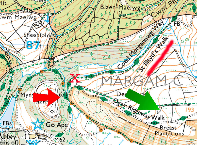
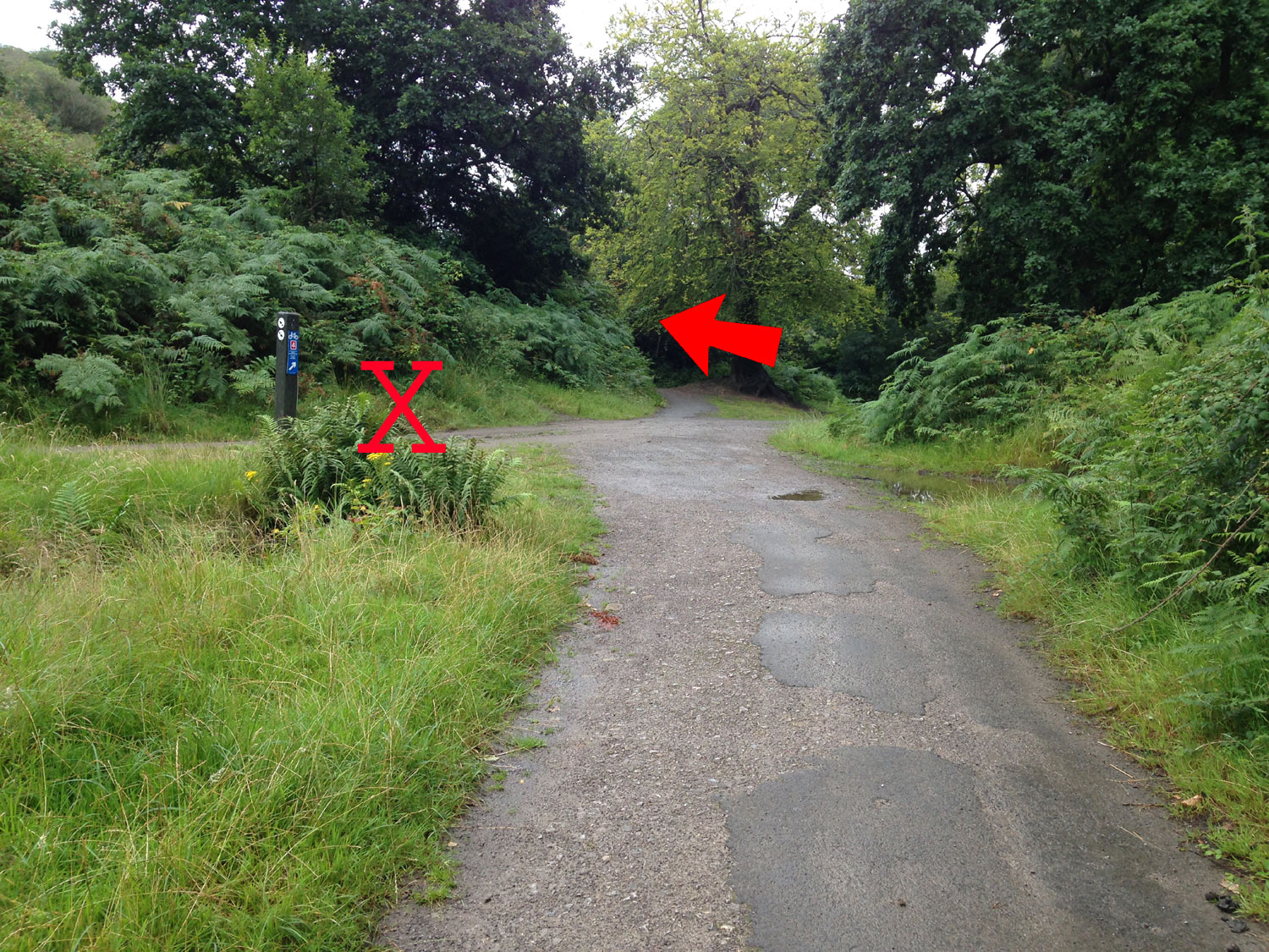
The map clearly shows St. Illtyd's and the Coed Morgannwg Way splitting from the Ogwr Ridgeway Walk, however, the St Illtyd's route is signposted to follow the Ogwr Ridgeway Walk. This is how this junction looks on the ground, you get to the top of the hill and there is a path to the left that the map shows as the St Illtyds Walk. 


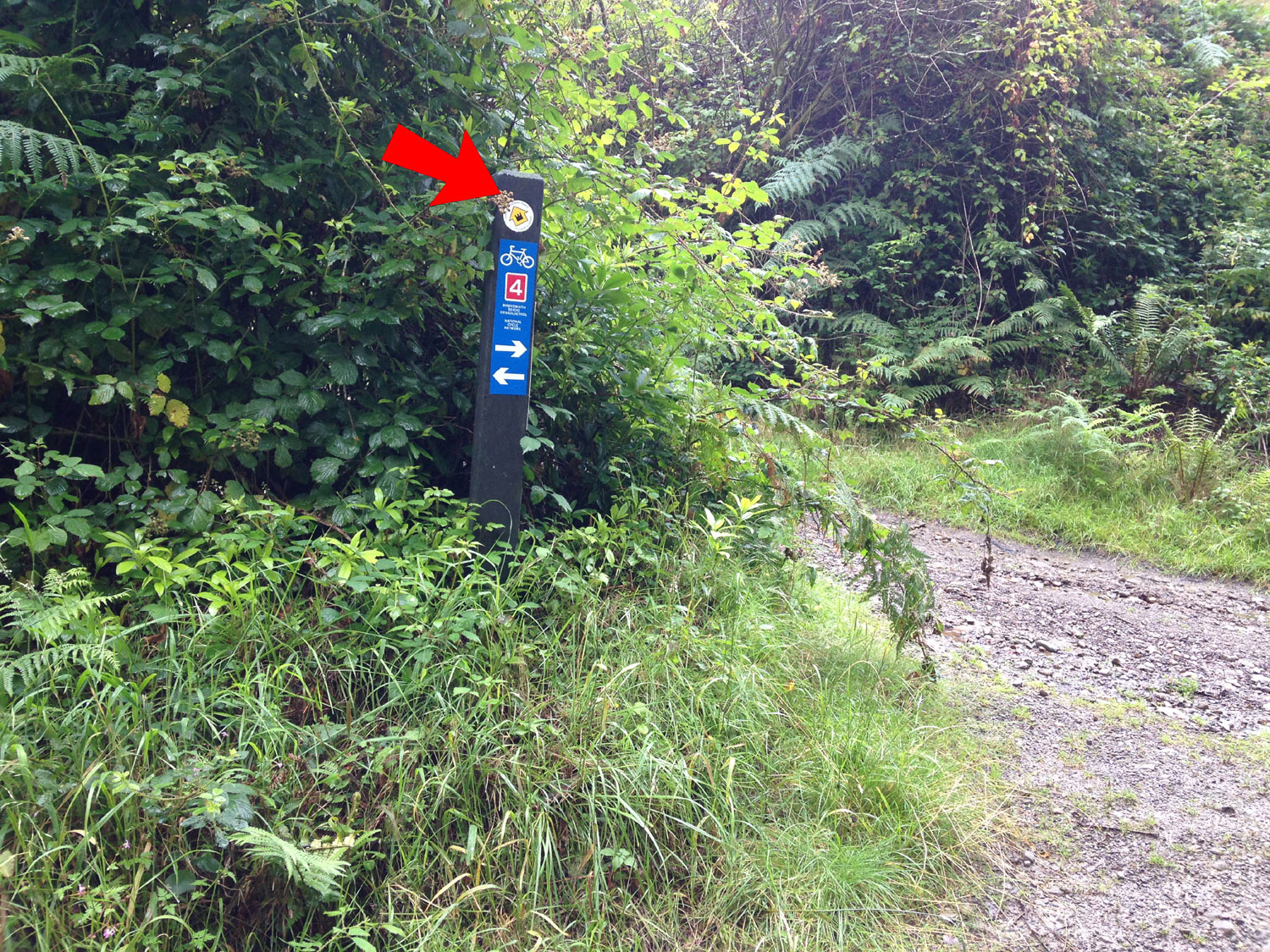
But if you travel a little further alon yu'll see that the waymarked route is the next track along on the left, this has a small sign on it.

Back to the my walk, as I trundled along I thought it slightly odd that the walk was not marked and then a right turn was either overgrown or moved and I realised that I'd have to carry on and make up the route myself and before you know it I was following a motorbike scramble track that got me to exactly where I needed to be. All those hours orienteering finally paid off and that's the first time I'd ever been thankful for a motorbike track. On reaching the far point of the walk at the junction with the Ogwr Ridgeway the heavens opened and I was robbed of superb views of the Gower and West Wales coast. The walk headed back towards the park on a nice grassy track and I suddenly realised that I was following the actual St Illtyd's Walk route as it is marked on the ground and not the one on my map. 

86.jpg (352311 bytes) 
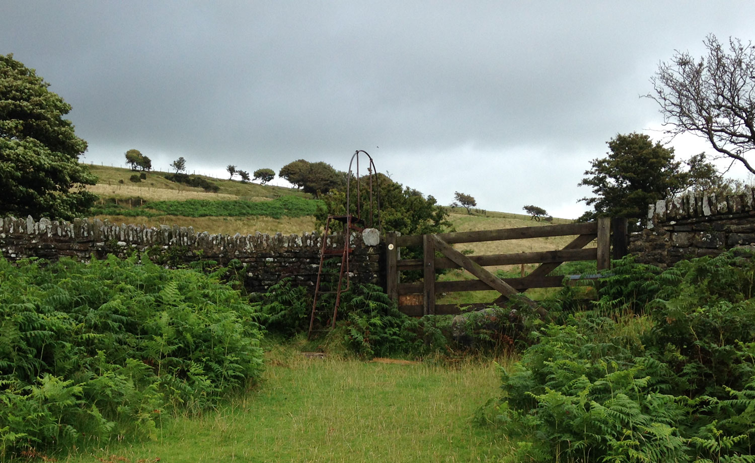
The track back down into the park was nice and grassy but it was quite a climb over the wall.

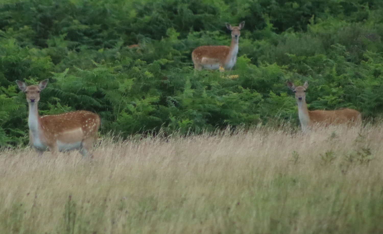
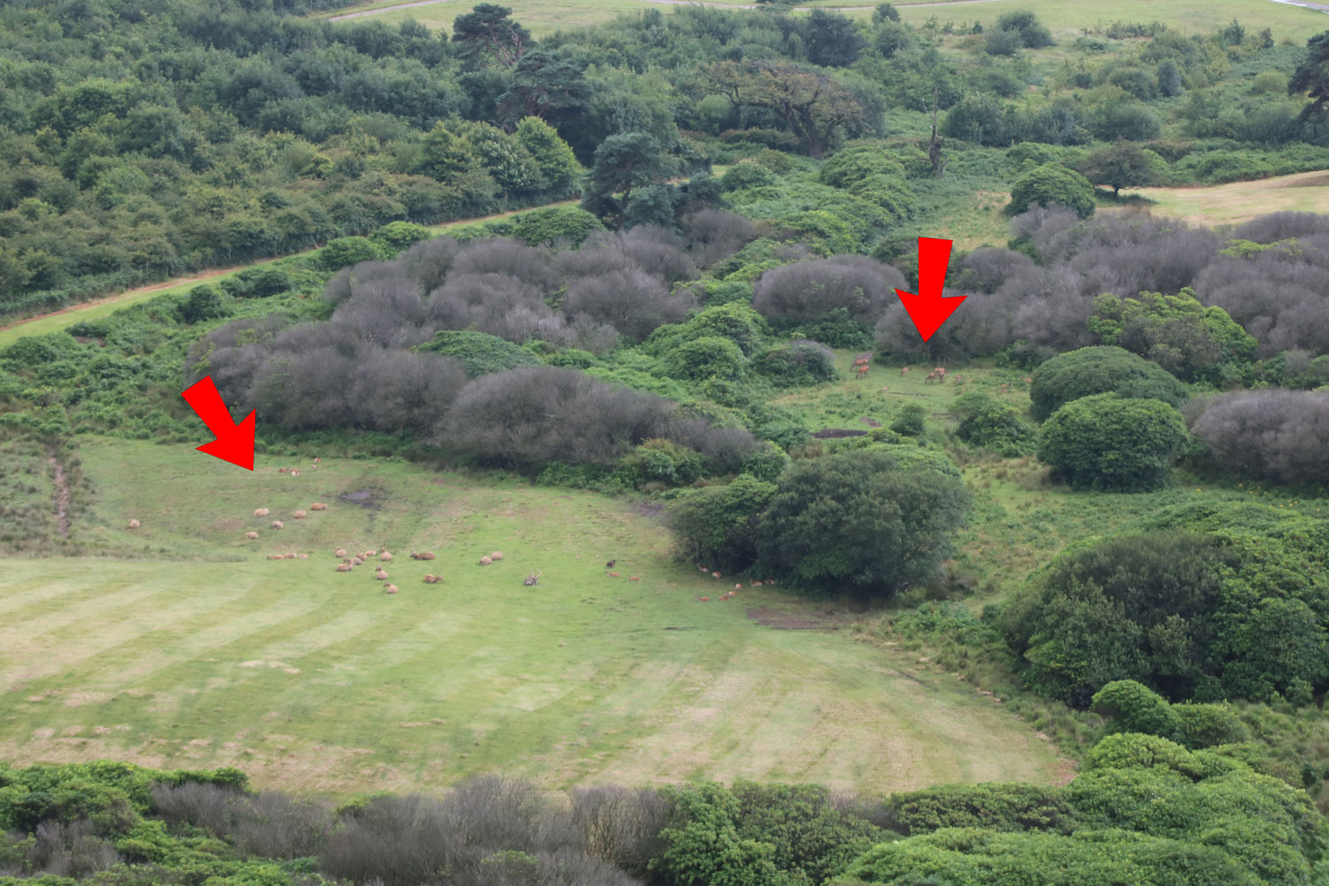
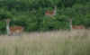
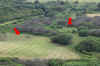
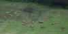
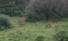
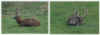
Once into the park it was time to get the camera out for some photos of the deer. The long distance photos were taken from the large stone overlooking the park. Seeing the large stags with antlers brought back memories of the time I was orienteering in the park and I rounded a corner to become face to face with a large stag, I turned around and went the other way.  

91.jpg (195032 bytes)  96.jpg (345152 bytes) 94.jpg (185792 bytes) 95.jpg (192553 bytes) 93.jpg (41893 bytes)

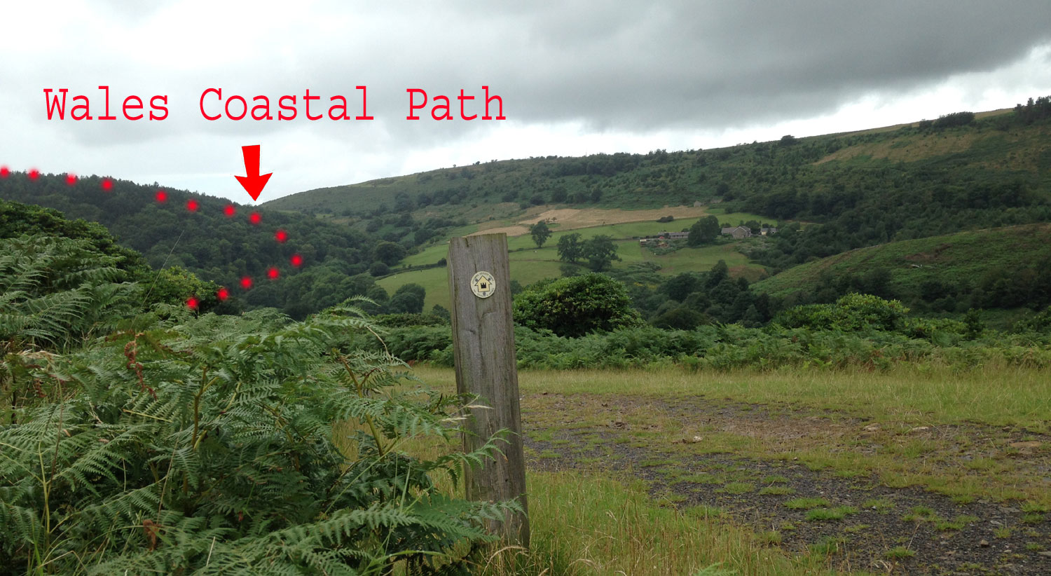
    Following the trail back down to the junction I could see the route of the Wales Coast Path in the distance that Hayley and I had followed earlier this year. The two paths, St Illtyd's and the Wales Coast Path almost touch near the Abbey.

.. ..

my walk on Garmin

(post blog note - I've checked a couple of websites such as GPS routes and the Long Distance Walkers Association and they all show the same route so its not an old map.)


CLICK HERE FOR JUNE 2017 BLOG

CLICK HERE FOR  AUGUST 2017 BLOG


Search the website with Google


HOME  -  DAI'S BLOG HOME