ENZO HOME  -  HOME

THE SITE HAS HISTORICALLY BEEN LANDFILL & WETLANDS


THE LAND IS INCORRECTLY IDENTIFIED AS SUITABLE FOR HOUSING DEVELOPMENT

The land on which the proposed Enzo development is planned has been misrepresented on the Local Development Plan. This plan states that the land is 'gently sloping' and suitable for housing development. However, the land has been both a domestic (1936-1971) and industrial (2003-2017) landfill site for the majority of its modern existence site with wetlands/peat bog covering the remaining area.

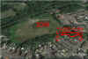
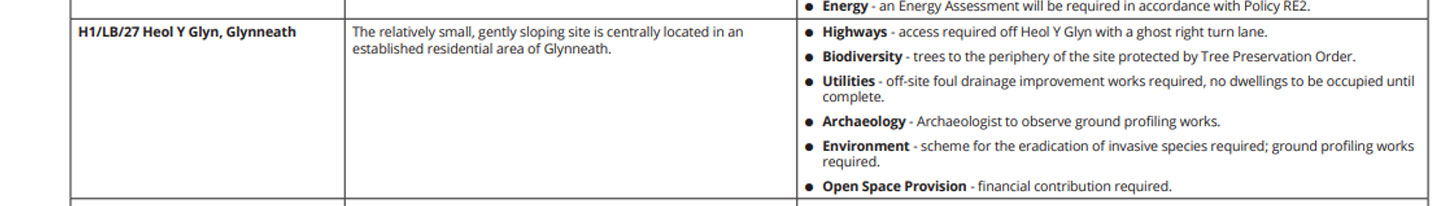
On the Neath Port Talbot County Borough Council Local Development Plan adopted in January 2016 - (CLICK HERE for the LDP) the land at Heol-y-Glyn has been identified for housing development. It is described as 'gently sloping'. 
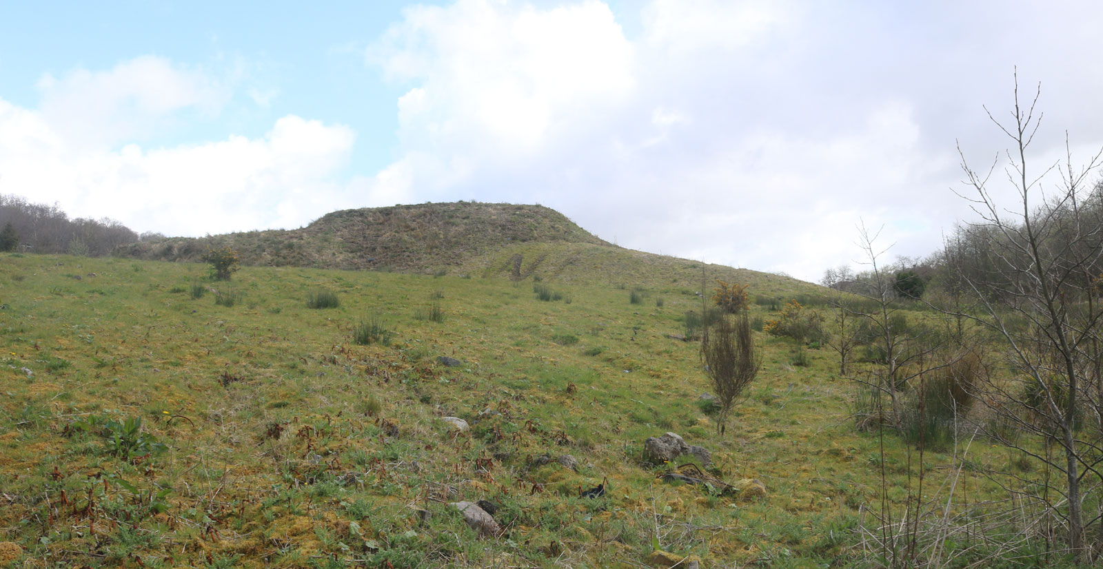
42-20160100a-DO-NPTC-local..jpg (62502 bytes)

However the land is far from gently sloping it is a large plateau of industrial waste with a steep bank and a flood plain. 

23-20200406-IM-chem06.jpg (298863 bytes) 24-20200406-IM-chem05.jpg (626760 bytes) 

Over the last 90 years it has had two historical uses.

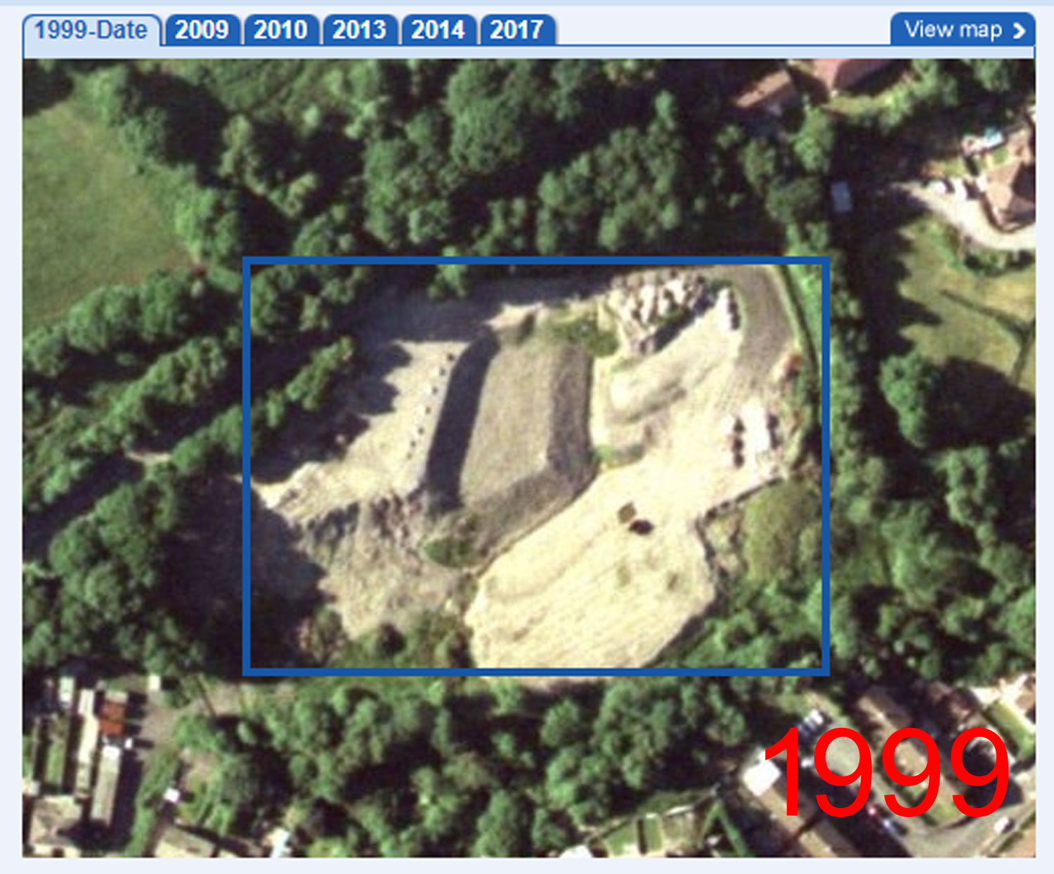
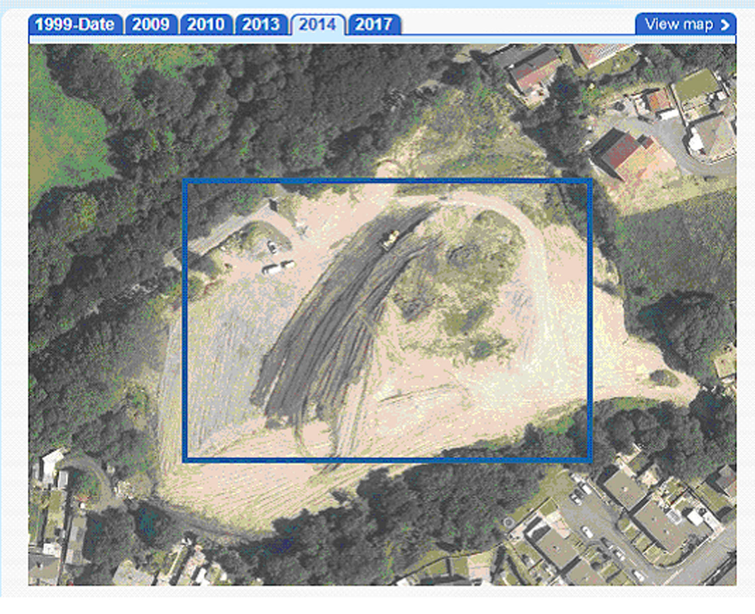
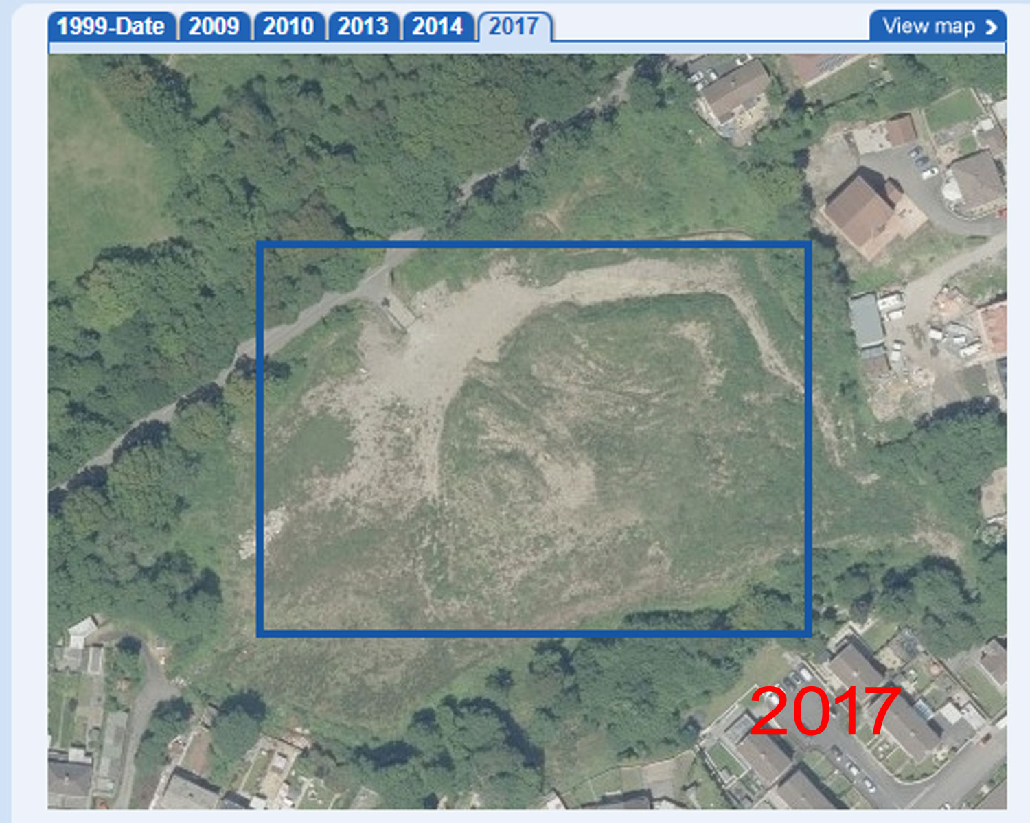
1. LANDFILL - Historically the land has been used for the last 90 years as landfill. However, there is no information about the land having previously been used for municipal or industrial landfill in the Local Development Plan . 
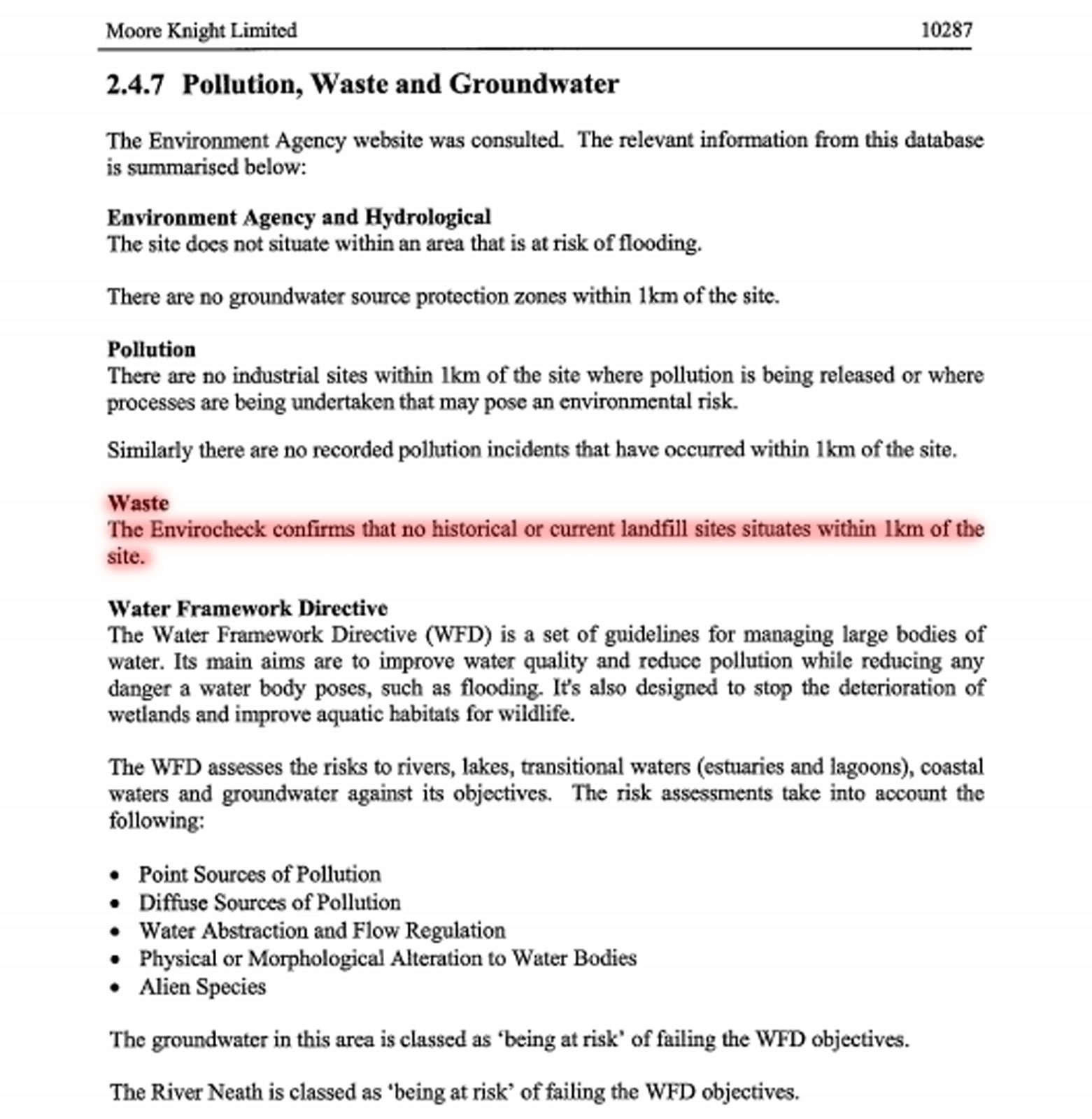
The 2008 survey states that here has been no historical evidence of a landfill location for 1km. This information is taken off Ordnance Survey maps and is clearly 
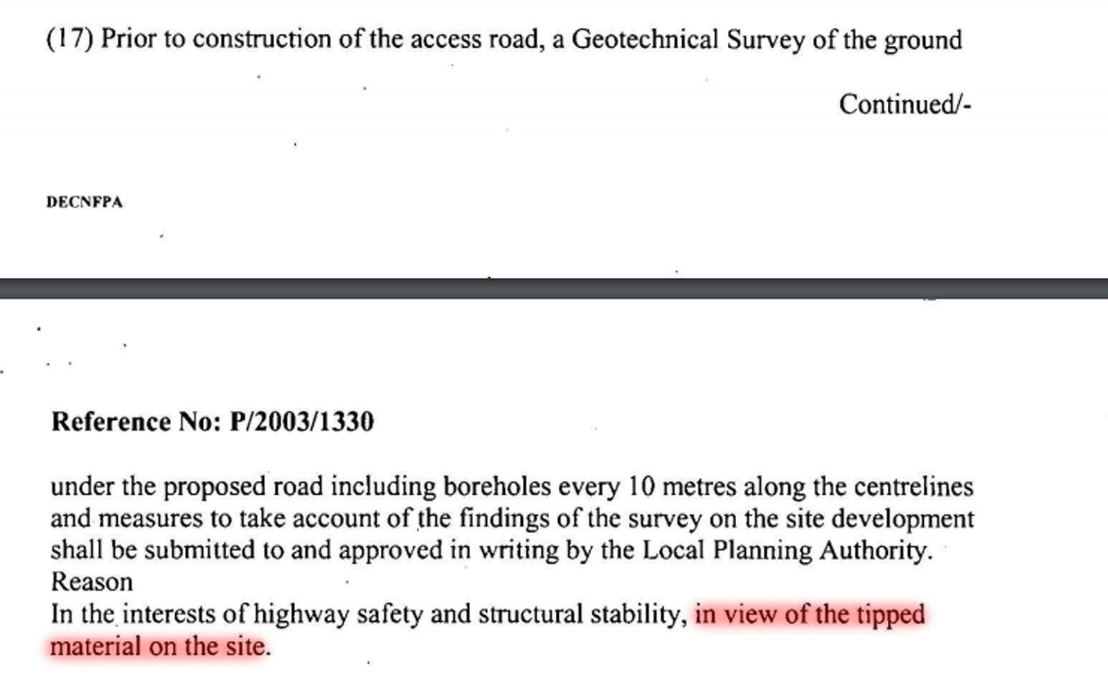
incorrect. In the 2003 planning approval on the site conditions 17 and 18 refer to the access road to the site requiring testing prior to the construction of the access road because the land had been 'tipped on'.  This provides evidence that the Neath Port Talbot Council Planning Department were already aware that the land had been used as industrial landfill. Local residents who have lived in Glynneath all their life always refer to the land as 'the tip'. This includes 84 year old Ray Jones whose father was the refuse collector in the 1930's and 1940s and Moira Harris who's grandfather Will Carder started the tip circa 1936/7. 

Testimonials collected from other residents provide evidence that the land has always been either a council or industrial landfill site. 

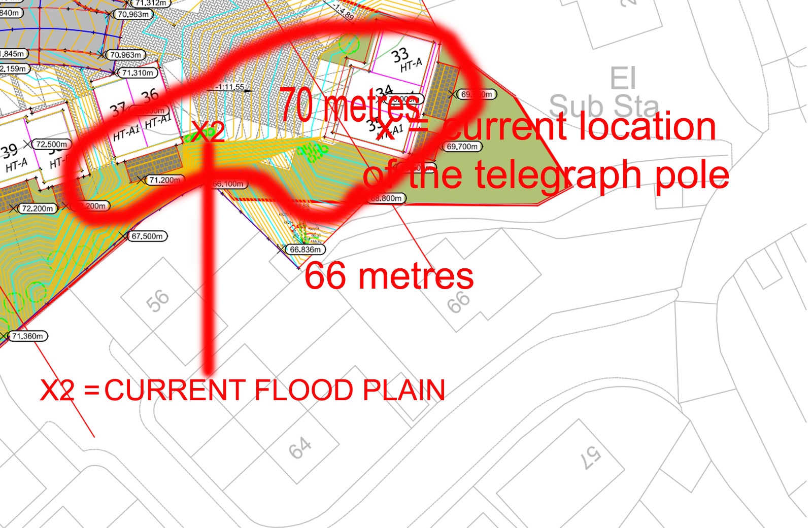
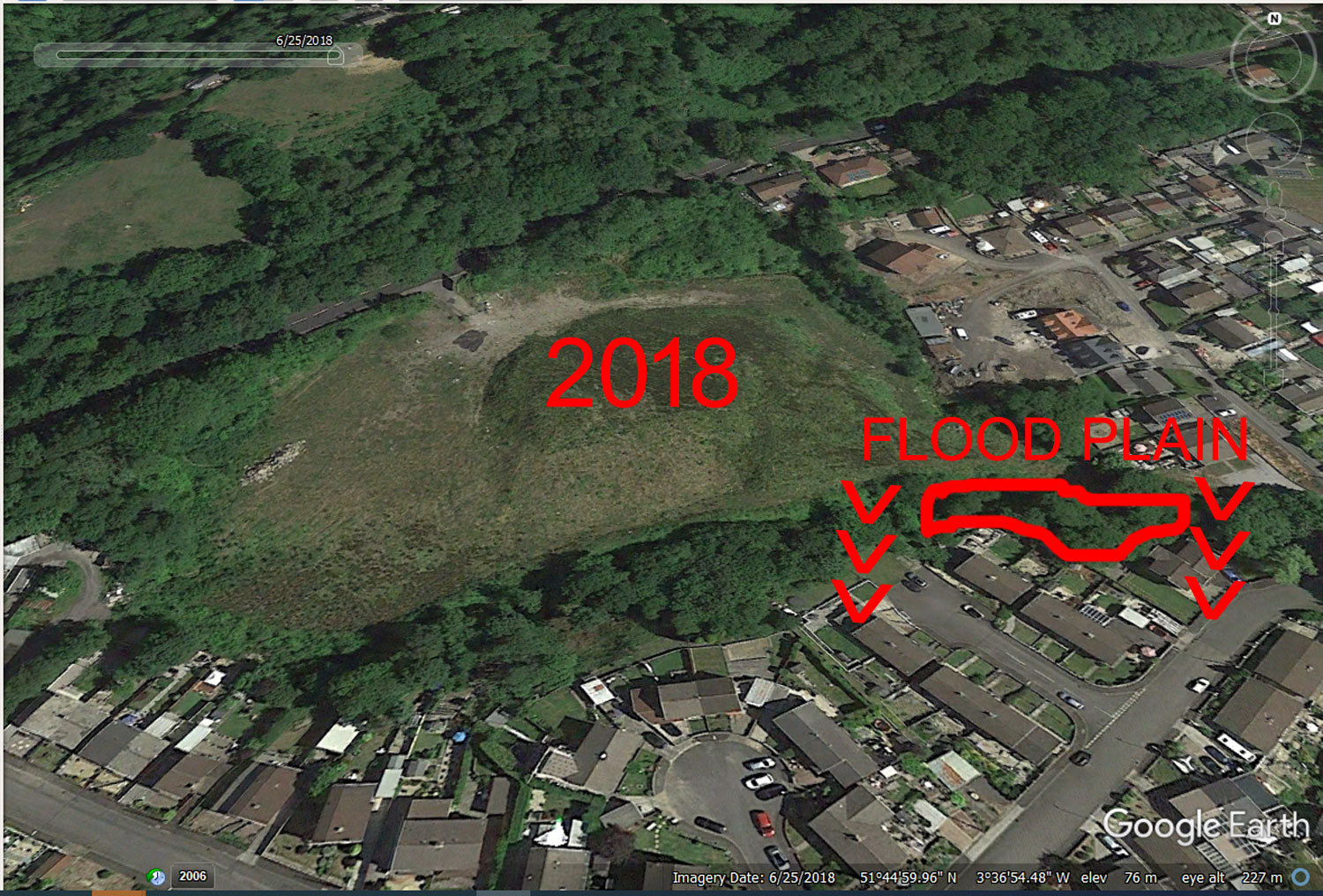
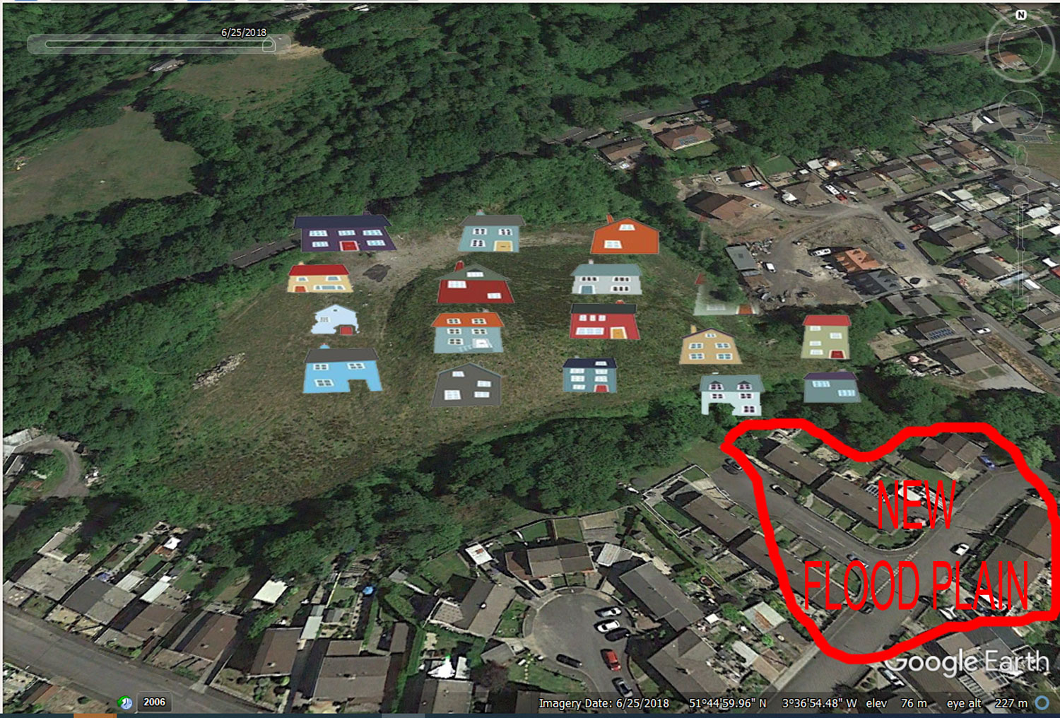
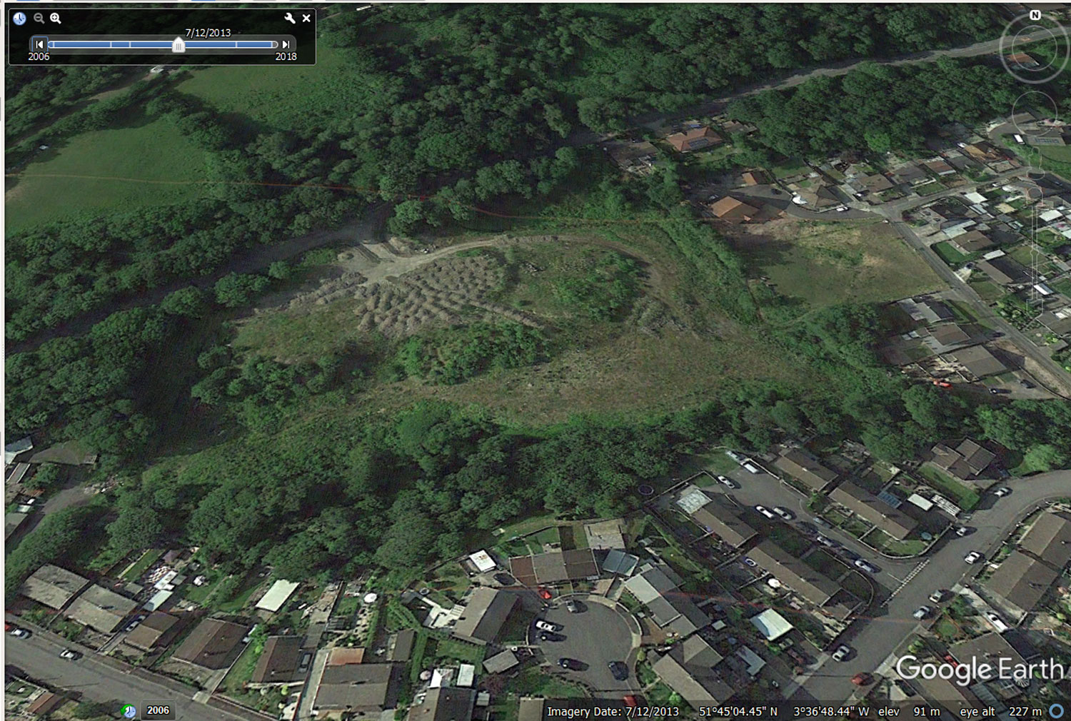
2. FLOOD PLAIN - The land in the south west of the proposed development acts as an inland flood plain. The plan shows several houses being built in the location. The land has historically been known by residents as 'the bog' because it has traditionally been a flood plain / marshland area. In heavy rain the surface water on the site has always flowed to that corner and two streams converge in the corner causing the area to 'flood' in heavy rain. The ground was tested to 3 metres in 2008 which showed only peat at the location. The 'bog' is situated above a fault line in the earth's crust. The 2008 survey 'assumed' that no-one would build there because in the words of a local resident 'only an idiot would build houses there'. Building on the flood plain will move it to the neighbouring properties (see illustrations below of the areas and streams in flood).

00w.jpg (371765 bytes) 00v.jpg (461044 bytes) 00x.jpg (312368 bytes) 89-2018-marked2.jpg (452851 bytes) 91-2022-marked.jpg (454665 bytes)

ACCOUNTABILITY - Neath Port Talbot Council are negligent. The person or persons accountable for the accuracy of the information about the Heol-y-Glyn site in the Local Development Plan (page 132 row 2) is/are negligent for not undertaking due diligence. They have not identifiied that this land which had been historically used as landfill for the last 90 years or as an inland flood plain. They have said incorrectly that it was suitable for housing development.

ACCOUNTABILITY - Glynneath Town Council and County Councillors for the area of the development land are negligent for not undertaking due diligence in scrutinising the information made available to them by the NPT Council. Notably the  Local Development Plan and planning applications by the Cuddy Group. Specifically the 2003 initial application, passed on 12 July 2005 (20050712a-WB-NPTC-CUDD-plan-approval) and the 2010 planning application relating to condition 17 which failed to include conditions on the remediation of the site as identified in the 2008 Geo-Technical and Geo-Environmental report. (20081106a-WB-NPTC-CUDD=cond17 - CLICK HERE).


TIMELINE & FURTHER ACCOUNTABILITY

2003 63.jpg (116832 bytes) Condition 17 (& 18 not illustrated) from the initial 2003 planning approval (P2003/1330) provide evidence that the NPTC Planning department were aware of the land's historical usage as landfill. 

The use of the term "in view of the tipped material on the site." is evidence of this.

From the lack of evidence of a registration in the previous planning applications on the site it must be assumed that the waste landfill added by the Cuddy Group has been unregisitered. 

2008

46-no-tip-marked.jpg (231378 bytes)

45-no-tip-cut.jpg (18818 bytes)


38-20080500a-DO-TFIR-CUDD-m.jpg (147697 bytes)

Conflicting evidence in the 2008 geo-technical report shows that the land was already being used by the Cuddy Group as unregistered landfill. It was said that "Made ground is known to overlie the superficial deposits across the majority of the site", the report used Envirocheck, a consultancy firm from Reading, Berkshire for this information. They provided information that no historical or current landfill sites situates within 1km of the site" The British Geological Survey defines made ground as:

"Made ground — man-made deposits such as embankments and spoil heaps on the natural ground surface."

ACCOUNTABILITY - The company submitting the report, Terra Firma (Wales) Ltd., have misrepresented the information contained within it. The introduction of the report says that checks were made by the Environment Agency and evidence contained in the historical information document shows that Envirocheck a commercial company based in Reading, Berkshire provided this information.

ACCOUNTABILITY - NPTC Planning Department are negligent for accepting this survey and not checking back against the 2003 approved plans to see how this information compares with the approval in place. What is clear from the 2008 survey is that this survey should have been conducted before any planning applications contained on the site were approved. They have not undertaken due dilligence as to its contents.

2016 24-20200406-IM-chem05.jpg (626760 bytes) On 29 March 2020 we forwarded email chain from 2016 which included Nicola Lake and Steve Ball as planning officers on the Cuddy development. We added a cover letter as an objection. The email chain provided proof that the land was being used as industrial landfill in 2016. 

The email exchange in 2016 provided evidence that NPTCBC are negligent in allowing Cuddy to tip for 6 years and not re-defining the land as industrial landfill on the Local Development Plan in 2016 . - CLICK HERE FOR THIS EMAIL  -  20200329a-EM-RICD-NPTC-cuddy-2016-1

Below is an excerpt from this email sent on 29/3/2020 to Nicola Lake, NPTC Planning Department

"Condition 27 of the 2010 approval stated that tipping should cease 12 months after commencement. Satellite images of the site readily available on line show that this is not the case. Your department and the local councillors of Glynneath are negligent for allowing this to happen. That the Cuddy Group continued to tip industrial waste on the site without attempting to improve the access road is evidence that their intent was to tip industrial waste as opposed to building houses. The company Primrose Homes is also evidence of this, it remained a dormant company (not trading) from its creation in 2006 to the Cuddy Groups demise in 2018. Primrose Homes  also known as Heol-y-Glyn Developments Ltd did not build a house in the 12 years of its existence."


In April 2022 NPTC were in the process of revising the Local Development Plan so we asked for the process on how to revise the land based upon full historical review so that the true nature of the site could be correctly represented n the LDP. The following is a short exchange between Carl Comerford, a Senior Planning policy Officer at NPTC and David Richards, a resident bordering the site. 


7/4/22   Initial enquiry - 20220407A-EM-RICD-rldp - Dai Richards to NPTC


11/4/22    

Reply from Carl Comerford NPTC and our response. - 20220411A-EM-NPTC-rldp


17/5/22   Repeated request for a full historical review of the site.

Can the council please identify the process by which a full historical review of a site currently on the LDP can take place so that the true nature of the land can be correctly represented on the LDP?


Search the website with Google


HOME